1
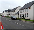
New houses, St Brides Road, Wick, Vale of Glamorgan
Viewed across the B4265 in August 2019. A June 2011 Google Street View shows green fields here.
Image: © Jaggery
Taken: 28 Aug 2019
0.01 miles
2
Recently-built house, St James Road, Wick, Vale of Glamorgan
On the corner of the B4265 St Brides Road viewed in August 2019.
A June 2011 Google Street View shows green fields here.
Image: © Jaggery
Taken: 28 Aug 2019
0.02 miles
3
Ewenny Road side of the Star Inn, Wick, Vale of Glamorgan
Pub and restaurant on the corner of Ewenny Road and St Brides Road.
Image: © Jaggery
Taken: 30 Aug 2019
0.03 miles
4
Star Inn, Wick, Vale of Glamorgan
The B4265 St Brides Road side of the Star Inn pub & restaurant in Ewenny Road.
Image: © Jaggery
Taken: 28 Aug 2019
0.03 miles
5
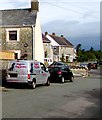
Waggaroo Dog Services van, Ewenny Road, Wick, Vale of Glamorgan
The business is based at New Candlestone in Bridgend.
Image: © Jaggery
Taken: 30 Aug 2019
0.03 miles
6
Electricity substation under a tree, Wick, Vale of Glamorgan
The large cabinet is a Western Power Distribution electricity substation. Its identifier is S/S 564182
Image: © Jaggery
Taken: 28 Aug 2019
0.04 miles
7
The Star Inn, Wick, Vale of Glamorgan
The Star Inn is located alongside the B4265 on the north west side of the village of Wick.
Image: © Peter Wasp
Taken: 21 Mar 2007
0.04 miles
8
North along Ewenny Road, Wick, Vale of Glamorgan
From the corner of the B4265 St Brides Road.
Image: © Jaggery
Taken: 30 Aug 2019
0.04 miles
9
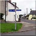
Cycle route 88 signpost on a corner of Wick in the Vale of Glamorgan
National Cycle Network Route 88 signpost on the corner of St Brides Road and David Street.
Left for St Donats (3 miles), Llantwit Major (5), right for Bridgend (5).
The names are also in Welsh.
Image: © Jaggery
Taken: 28 Aug 2019
0.05 miles
10
Bilingual direction sign in Wick, Vale of Glamorgan
Sports ground is Maes chwaraeon in Welsh.
Image: © Jaggery
Taken: 28 Aug 2019
0.06 miles


