
IMAGES TAKEN NEAR TO
Twyn-yr-Eglwys, COWBRIDGE, CF71 7NN
Introduction
This page details the photographs taken nearby to Twyn-yr-Eglwys, CF71 7NN by members of the Geograph project.
The Geograph project started in 2005 with the aim of publishing, organising and preserving representative images for every square kilometre of Great Britain, Ireland and the Isle of Man.

There are currently over 7.5m images from over14,400 individuals and you can help contribute to the project by visiting https://www.geograph.org.uk
Image Map
Images are licensed for reuse under creativecommons.org/licenses/by-sa/2.0
Notes
- Clicking on the map will re-center to the selected point.
- The higher the marker number, the further away the image location is from the centre of the postcode.
Image Listing (19 Images Found)
Images are licensed for reuse under creativecommons.org/licenses/by-sa/2.0
Image
Details
Distance
1
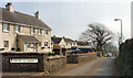
Twyn yr Eglwys
The literal translation is Church Hill. This particular road leads downhill to the Church in Colwinston.
Image: © kenneth rees
Taken: 28 Mar 2007
0.01 miles
2

Ordnance Survey Rivet
This OS rivet can be found on the wall of No5 Twyn Yr Eglwys. It marks a point 59.747m above mean sea level.
Image: © Adrian Dust
Taken: 1 Sep 2021
0.02 miles
3
Church of St Michael & All Angels, Colwinston
Image: © John Lord
Taken: 23 Nov 2010
0.04 miles
4
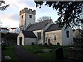
Church of St Michael & All Angels, Colwinston
Image: © John Lord
Taken: 23 Nov 2010
0.04 miles
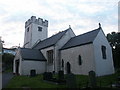
6
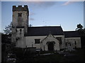
St Michael's Church and churchyard, Colwinston
Image: © John Lord
Taken: 23 Nov 2010
0.04 miles
7
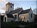
Church of St Michael & All Angels, Colwinston
Image: © John Lord
Taken: 23 Nov 2010
0.05 miles
8
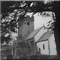
The Church of St Michael and All Angels, Colwinston in the 1970s
A view of the church from c. 1975. Parts of the church are thought to date from the Norman period. One internet source (http://www.coflein.gov.uk/en/site/307572/details/ST+MICHAEL+AND+ALL+ANGELS+CHURCH,+COLWINSTON/ ) notes that the font and chancel arch are thought to be 12th century. Another source (http://www.valeofglamorgan.gov.uk/files/Living/Planning/Policy/County_Treasures/Colwinston.pdf - see also http://en.wikipedia.org/wiki/Colwinston ) notes that the church is reputed to have been originally built in 1111. According to this source, the church was restored in 1879 and suffered damage in a fire in 1971.
It may be noted that at the time the photograph was taken only some of its exterior walls were rendered and limewashed, whereas more recent pictures of the church reveal that later they all came to be.
The church is a grade I listed building. It was listed in February 1963.
Image: © eswales
Taken: Unknown
0.05 miles
9
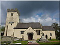
St Michaels and All Angels, Colwinston
The roots of this church are Norman with the nave, font and chancel arch dating from this period. The tower probably dates from the sixteenth century and was heightened in the late 17th or early 18th century. The windows largely date from the 16th century as well. There was a Victorian restoration and the church was re-roofed, redecorated and given the north vestry for the millennium.
The church is a grade 1 listed building.
Image: © Colin Cheesman
Taken: 30 Apr 2021
0.05 miles
10
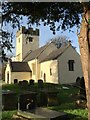
The Church of St.Michael and All Angels
The Church of St.Michael and All Angels, Colwinston.
Image: © Alan Hughes
Taken: 29 Dec 2015
0.05 miles