1
The Sycamore Tree
Pub Sign for The Sycamore Tree, Colwinston
Image: © Alan Hughes
Taken: 29 Dec 2015
0.02 miles
2
The Sycamore Tree
The Sycamore Tree, Colwinston.
Image: © Alan Hughes
Taken: 29 Dec 2015
0.02 miles
3
The Sycamore Tree, Colwinston
Image: © John Lord
Taken: 23 Nov 2010
0.03 miles
4
The Old Parsonage
The Old Parsonage, Colwinston, viewed from the south.
Image: © Alan Hughes
Taken: 29 Dec 2015
0.05 miles
5
Ordnance Survey Cut Mark
This OS cut mark can be found on the SE face of St Michael's Church. It marks a point 48.954m above mean sea level.
Image: © Adrian Dust
Taken: 4 May 2015
0.05 miles
6
The Old Parsonage
The Old Parsonage, Colwinston - opposite the church.
Image: © Alan Hughes
Taken: 29 Dec 2015
0.06 miles
7
The Church of St.Michael and All Angels
The Church of St.Michael and All Angels, Colwinston.
Image: © Alan Hughes
Taken: 29 Dec 2015
0.06 miles
8
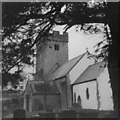
The Church of St Michael and All Angels, Colwinston in the 1970s
A view of the church from c. 1975. Parts of the church are thought to date from the Norman period. One internet source (http://www.coflein.gov.uk/en/site/307572/details/ST+MICHAEL+AND+ALL+ANGELS+CHURCH,+COLWINSTON/ ) notes that the font and chancel arch are thought to be 12th century. Another source (http://www.valeofglamorgan.gov.uk/files/Living/Planning/Policy/County_Treasures/Colwinston.pdf - see also http://en.wikipedia.org/wiki/Colwinston ) notes that the church is reputed to have been originally built in 1111. According to this source, the church was restored in 1879 and suffered damage in a fire in 1971.
It may be noted that at the time the photograph was taken only some of its exterior walls were rendered and limewashed, whereas more recent pictures of the church reveal that later they all came to be.
The church is a grade I listed building. It was listed in February 1963.
Image: © eswales
Taken: Unknown
0.06 miles
9
St Michaels and All Angels, Colwinston
The roots of this church are Norman with the nave, font and chancel arch dating from this period. The tower probably dates from the sixteenth century and was heightened in the late 17th or early 18th century. The windows largely date from the 16th century as well. There was a Victorian restoration and the church was re-roofed, redecorated and given the north vestry for the millennium.
The church is a grade 1 listed building.
Image: © Colin Cheesman
Taken: 30 Apr 2021
0.07 miles
10
St Michael's Church and churchyard, Colwinston
Image: © John Lord
Taken: 23 Nov 2010
0.07 miles


