IMAGES TAKEN NEAR TO
Carne Terrace, COWBRIDGE, CF71 7LN
Introduction
This page details the photographs taken nearby to Carne Terrace, CF71 7LN by members of the Geograph project.
The Geograph project started in 2005 with the aim of publishing, organising and preserving representative images for every square kilometre of Great Britain, Ireland and the Isle of Man.

There are currently over 7.5m images from over14,400 individuals and you can help contribute to the project by visiting https://www.geograph.org.uk
Image Map
Images are licensed for reuse under creativecommons.org/licenses/by-sa/2.0
Notes
- Clicking on the map will re-center to the selected point.
- The higher the marker number, the further away the image location is from the centre of the postcode.
Image Listing (7 Images Found)
Images are licensed for reuse under creativecommons.org/licenses/by-sa/2.0
Image
Details
Distance
1
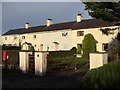
Carne Cottages
Carne Cottages near Llysworney.
Image: © Alan Hughes
Taken: 29 Dec 2015
0.01 miles
2

The start of a restricted byway south east of Llysworney
The image shows the south-western end of a grassy restricted byway, about 550 metres in length. This spot is situated approximately 300 metres south east of the edge of Llysworney/Llyswyrny beside a minor road.
Image: © eswales
Taken: 3 Jan 2026
0.05 miles
3
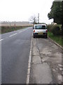
The B4270 near the junction at the Grange
Looking south-west.
Image: © HelenK
Taken: 22 Feb 2008
0.06 miles
4
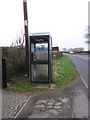
Phone box on the B4270
You'll need a card with you to use it.
Image: © HelenK
Taken: 22 Feb 2008
0.08 miles
5
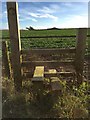
Stile and Waymarker
Stile leading From Llantwit Major road to farm buildings.
Image: © Alan Hughes
Taken: 29 Dec 2015
0.10 miles