
IMAGES TAKEN NEAR TO
Llantwit Major Road, COWBRIDGE, CF71 7JP
Introduction
This page details the photographs taken nearby to Llantwit Major Road, CF71 7JP by members of the Geograph project.
The Geograph project started in 2005 with the aim of publishing, organising and preserving representative images for every square kilometre of Great Britain, Ireland and the Isle of Man.

There are currently over 7.5m images from over14,400 individuals and you can help contribute to the project by visiting https://www.geograph.org.uk
Image Map
Images are licensed for reuse under creativecommons.org/licenses/by-sa/2.0
Notes
- Clicking on the map will re-center to the selected point.
- The higher the marker number, the further away the image location is from the centre of the postcode.
Image Listing (29 Images Found)
Images are licensed for reuse under creativecommons.org/licenses/by-sa/2.0
Image
Details
Distance
1
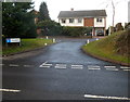
Short connecting road to Tyla Rhosyr, Cowbridge
Tyla Rhosyr http://www.geograph.org.uk/photo/3638855 is a residential street on the north side of the B4270 Llantwit Major Road.
Image: © Jaggery
Taken: 27 Jan 2012
0.08 miles
2
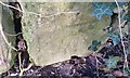
Ordnance Survey Cut Mark
This OS cut mark can be found on the wall SE side of Llantwit Major Road. It marks a point 46.735m above mean sea level.
Image: © Adrian Dust
Taken: 19 Apr 2018
0.10 miles
3
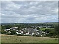
West Village, Cowbridge
Viewed from the slopes of Llanblethian Castle.
Image: © Alan Hughes
Taken: 15 Sep 2022
0.11 miles
4
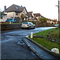
Tyla Rhosyr houses, Cowbridge
Tyla Rhosyr is a residential street on the north side of the B4270 Llantwit Major Road.
Image: © Jaggery
Taken: 27 Jan 2012
0.12 miles
5
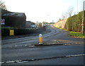
Darren Hill near Cowbridge
The A4222 Darren Hill passes Darren Farm. Just out of shot ahead, the A4222 joins the A48.
Old maps show that before the construction of the A48 Cowbridge Bypass at the northern edge of town, this was the route of the A48 which formerly passed through the centre of Cowbridge.
Image: © Jaggery
Taken: 19 Jan 2012
0.15 miles
6
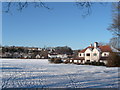
Looking north across snow-bound rugby field
Image: © Ron Speed
Taken: 7 Jan 2010
0.15 miles
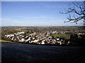
8
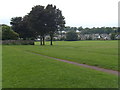
School playing fields Cowbridge
Western part of Cowbridge as seen across school rugby field.
Image: © Ron Speed
Taken: Unknown
0.15 miles
9
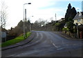
Llantwit Major Road, Cowbridge
The B4270 climbs away from the A4222.
The sign on the left points towards Llantwit Major and Llandow Industrial Estate.
Image: © Jaggery
Taken: 19 Jan 2012
0.15 miles
10
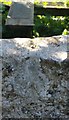
Ordnance Survey Rivet
This OS rivet can be found on the stile SE side of the road. It marks a point 63.249m above mean sea level.
Image: © Adrian Dust
Taken: 19 Apr 2018
0.16 miles