IMAGES TAKEN NEAR TO
Downs View, COWBRIDGE, CF71 7HF
Introduction
This page details the photographs taken nearby to Downs View, CF71 7HF by members of the Geograph project.
The Geograph project started in 2005 with the aim of publishing, organising and preserving representative images for every square kilometre of Great Britain, Ireland and the Isle of Man.

There are currently over 7.5m images from over14,400 individuals and you can help contribute to the project by visiting https://www.geograph.org.uk
Image Map
Images are licensed for reuse under creativecommons.org/licenses/by-sa/2.0
Notes
- Clicking on the map will re-center to the selected point.
- The higher the marker number, the further away the image location is from the centre of the postcode.
Image Listing (10 Images Found)
Images are licensed for reuse under creativecommons.org/licenses/by-sa/2.0
Image
Details
Distance
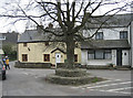
2
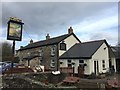
Hare and Hounds
The Hare and Hounds, Aberthin.
Image: © Alan Hughes
Taken: 13 Jan 2017
0.12 miles
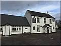
3
Hare and Hounds
The Hare and Hounds - village pub / restaurant near Cowbridge.
Image: © Alan Hughes
Taken: 29 Sep 2018
0.12 miles
5
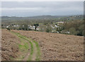
Aberthin, South Wales
View from footpath leading up to Stalling Down.
Image: © Peter Wasp
Taken: 16 Mar 2007
0.13 miles
6
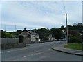
Aberthin, near Cowbridge.
The attractive village of Abertin sits on the busy A4222 just north of Cowbridge.
Image: © Peter Wasp
Taken: 16 Mar 2007
0.14 miles
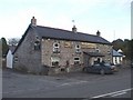
7
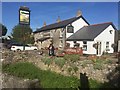
Farmers Arms
The Farmers Arms, Aberthin.
Image: © Alan Hughes
Taken: 13 Jan 2017
0.15 miles
8
The Hare & Hounds, Aberthin, near Cowbridge
Image: © John Lord
Taken: 7 Nov 2008
0.15 miles
9
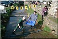
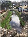
The Village Duck Race
Held each February as a fund raising venture for the village hall activities.
Image: © Mike Baker
Taken: 4 Mar 2001
0.16 miles
10
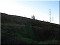
Mountain bike track on Stalling Down
Stalling Down has various unofficial downhill racing tracks for mountain bikers
Image: © M Hunter
Taken: 26 Dec 2008
0.24 miles