1
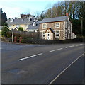
Llwynhelig H?use
Llwynhelig House, Cowbridge.
Image: © Alan Hughes
Taken: 7 Nov 2016
0.06 miles
2
Northern boundary of Cowbridge
The boundary sign is alongside the A4222 at the edge of the bridge
carrying the A48 Cowbridge Bypass. Cowbridge is a small market town
in the Vale of Glamorgan, 11 km west of Cardiff.
Its Welsh name is Y Bont Faen, literally The Stone Bridge.
Image: © Jaggery
Taken: 19 Jan 2012
0.09 miles
3
South side of the Cowbridge Bypass bridge over the A4222 in Cowbridge
The bridge carries the A48 Cowbridge Bypass over the A4222 at the northern edge of Cowbridge.
The town's northern boundary sign http://www.geograph.org.uk/photo/3638869 is on the far side of the bridge.
Image: © Jaggery
Taken: 19 Jan 2012
0.10 miles
4
Road Junction
Slip road onto the A48, eastbound, at Cowbridge.
Image: © Alan Hughes
Taken: 7 Nov 2016
0.12 miles
5
Corner of Westgate and Llantwit Major Road, Cowbridge
The location is the NW edge of Cowbridge.
Image: © Jaggery
Taken: 19 Jan 2012
0.15 miles
6
A4222 approaches a major junction in the NW of Cowbridge
Viewed along the A4222 Westgate, this is the approach to the A48 Cowbridge Bypass.
Image: © Jaggery
Taken: 19 Jan 2012
0.16 miles
7
West end of Cowbridge
The road to the left leads to Llandow and back to Llantwit Major and the road ahead to the A48, west to Bridgend and east to Cardiff.
Image: © Mick Lobb
Taken: 20 Apr 2009
0.16 miles
8
Modern houses in The Broad Shoard, Cowbridge
Located between Westgate and Cowbridge Athletic Club.
Image: © Jaggery
Taken: 19 Jan 2012
0.17 miles
9
Hopyard Meadow, Cowbridge
Hopyard Meadow is a cul-de-sac on the south side of the A4222 Westgate.
Image: © Jaggery
Taken: 19 Jan 2012
0.18 miles
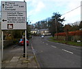
10
Llantwit Major Road, Cowbridge
The B4270 climbs away from the A4222.
The sign on the left points towards Llantwit Major and Llandow Industrial Estate.
Image: © Jaggery
Taken: 19 Jan 2012
0.18 miles


