1
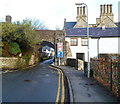
The South Gate, Cowbridge
The South Gate was one of the medieval town's defensible gates and an access point into the town for residents in times of strife, when a night time curfew was imposed and the town guarded and managed. Most of the significant medieval towns in Wales had such arrangements and walled towns include Monmouth, Conwy (probably the best example), Abergavenny, Chepstow, Tenby etc. Not many gates survive though.
Image: © Jeremy Bolwell
Taken: 7 Jul 2011
0.01 miles
2
A low and narrow former town gate, Cowbridge
Viewed from Town Mill Road looking towards Church Street. The structure is the former South Gate through the town wall, built with medieval traffic in mind. Signs shows an overhead clearance of 7' 3" and a width of 6' 6". Vehicles heading away from the camera have priority over oncoming traffic.
South Gate was Grade II* listed in May 1963.
The ornate chimneys are part of the former Cowbridge Grammar School. http://www.geograph.org.uk/photo/3624440
Image: © Jaggery
Taken: 19 Jan 2012
0.01 miles
3
South Gate - Cowbridge
One of four gates into the old walled town. The main purpose of three of these was the collection of tolls from those going to market. North Gate,the base of which was recently discovered during excavation, gave access for stock to the marshlands to the north. The East and West gates were removed in the eighteenth century because they were an obstacle to stage coach traffic along the main road - a road that is unable to adequately cope with today's traffic.
Image: © Mick Lobb
Taken: 20 Apr 2009
0.01 miles
4
Kissing gate beside South Gate - Cowbridge
It is gratifying to see that, despite 'improvements' in the area, this old gate remains. Of such minor detail does a town's character prevail.
Image: © Mick Lobb
Taken: 20 Apr 2009
0.01 miles
5
South Gate, Cowbridge
The town's last remaining medieval gate.
Image: © Chris Andrews
Taken: 1 Feb 2012
0.01 miles
6
Church Street, Cowbridge
Looking SW from the High Street end.
Image: © Jaggery
Taken: 19 Jan 2012
0.01 miles
7
Former Cowbridge Grammar School
Viewed along Church Street, Cowbridge. A Cowbridge and District Local History Society blue plaque on the wall gives some of the key dates in the school's history. Established in 1608. Owned by Jesus College Oxford from 1685-1918. Rebuilt 1847-1852. Building restored 2006.
Other details are that Cowbridge Grammar School became a comprehensive school in September 1973. These buildings became disused soon afterwards, were derelict for several years, and were later converted to residential use.
Image: © Jaggery
Taken: 19 Jan 2012
0.01 miles
8
Voluntary work
A volunteer in the Cowbridge Physic Garden.
Image: © Alan Hughes
Taken: 15 Sep 2022
0.01 miles
9
South Gate - Cowbridge
Viewed from the north east side.
Image: © Mick Lobb
Taken: 20 Apr 2009
0.01 miles
10
The former Cowbridge Grammar School
Image: © John Lord
Taken: 9 Jan 2011
0.01 miles


