
IMAGES TAKEN NEAR TO
Rookery Wood, PENARTH, CF64 5TX
Introduction
This page details the photographs taken nearby to Rookery Wood, CF64 5TX by members of the Geograph project.
The Geograph project started in 2005 with the aim of publishing, organising and preserving representative images for every square kilometre of Great Britain, Ireland and the Isle of Man.

There are currently over 7.5m images from over14,400 individuals and you can help contribute to the project by visiting https://www.geograph.org.uk
Image Map
Images are licensed for reuse under creativecommons.org/licenses/by-sa/2.0
Notes
- Clicking on the map will re-center to the selected point.
- The higher the marker number, the further away the image location is from the centre of the postcode.
Image Listing (42 Images Found)
Images are licensed for reuse under creativecommons.org/licenses/by-sa/2.0
Image
Details
Distance
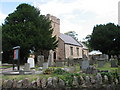
2
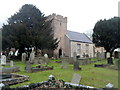
The Parish Church of St John Baptist, Sully
Viewed from the South Road side. The nameboard http://www.geograph.org.uk/photo/3258759 shows that there is no 'the' between John and Baptist. The church is in the Church in Wales parish of Sully in the diocese of Llandaff. The church is built on foundations dating from the Norman Conquest and the arrival of Reginald de Sully, one of the 12 knights of Baron Fitzhamon, in this area in c1093. When de Sully built his castle, he also built a church for himself and his retainers. That church was dedicated to St John the Baptist.
The church was Grade II listed in January 1963.
Image: © Jaggery
Taken: 2 Dec 2012
0.03 miles
3

Cross at St John the Baptist, Suly
Churchyard cross restored in 1927 to commemorate 7 sailors who drowned off the nearby coast
Image: © Eirian Evans
Taken: 22 Jun 2021
0.03 miles
4
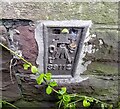
Ordnance Survey Flush Bracket (S9112)
This OS Flush Bracket can be found on the SW angle of the school. It marks a point 18.515m above mean sea level.
Image: © Adrian Dust
Taken: 14 May 2024
0.04 miles
5
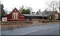
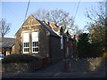
The Old School, Sully
Located on the north side of South Road, adjoining the eastern edge
of the churchyard of the Parish Church of St John Baptist. http://www.geograph.org.uk/photo/3258748
The Old School contains a new hall with adjoining dressing room/committee room and another
two meeting rooms in part of the original 19th century school building. The hall and the rooms can be hired individually or together for regular meetings or one-off activities and functions.
Image: © Jaggery
Taken: 2 Dec 2012
0.04 miles
7
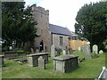
Parish Church of St John the Baptist, Sully
Early English style parish church, listed Grade II
Image: © Eirian Evans
Taken: 22 Jun 2021
0.04 miles
10
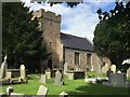
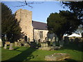
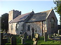
Sully Church
St. John Baptist Church, Sully.
Image: © Alan Hughes
Taken: 8 Aug 2016
0.04 miles