
IMAGES TAKEN NEAR TO
Raven Way, PENARTH, CF64 5FH
Introduction
This page details the photographs taken nearby to Raven Way, CF64 5FH by members of the Geograph project.
The Geograph project started in 2005 with the aim of publishing, organising and preserving representative images for every square kilometre of Great Britain, Ireland and the Isle of Man.

There are currently over 7.5m images from over14,400 individuals and you can help contribute to the project by visiting https://www.geograph.org.uk
Image Map
Images are licensed for reuse under creativecommons.org/licenses/by-sa/2.0
Notes
- Clicking on the map will re-center to the selected point.
- The higher the marker number, the further away the image location is from the centre of the postcode.
Image Listing (35 Images Found)
Images are licensed for reuse under creativecommons.org/licenses/by-sa/2.0
Image
Details
Distance
1
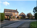
Cosmeston Drive, Lavernock
Houses at the western edge of Cosmeston Drive. The drive leads to about a dozen cul-de-sacs, which are all named on a large Cosmeston Drive street name sign at the corner of Lavernock Road, under the heading 'Leading To'
Image: © Jaggery
Taken: 24 Nov 2010
0.11 miles
2
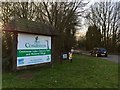
Cosmeston Park
Entrance to Cosmeston Lakes Country Park and Medieval Village.
Image: © Alan Hughes
Taken: 17 Feb 2017
0.12 miles
3
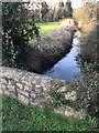
Stream at Cosmeston
Bridge over a stream alongside the Cosmeston Lakes Country Park.
Image: © Alan Hughes
Taken: 17 Feb 2017
0.13 miles
4
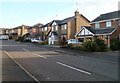
Houses, Upper Cosmeston Farm
Confusingly, this residential cul-de-sac is named Upper Cosmeston Farm. Houses on the south side, viewed from the Lavernock Road end.
Image: © Jaggery
Taken: 24 Nov 2010
0.16 miles
5
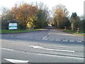
Entrance to Cosmeston Lakes Country Park and Medieval Village
Viewed across Lavernock Road (B4267).
Image: © Jaggery
Taken: 24 Nov 2010
0.17 miles
6
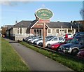
Schooner Inn, Lavernock
A Harvester pub and grill on the east side of Lavernock Road (B4267).
Image: © Jaggery
Taken: 24 Nov 2010
0.19 miles
7
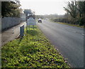
Welcome to Lavernock
Lavernock Road, heading south, reaches the boundary sign for Lavernock, a hamlet between Penarth and Sully in the Vale of Glamorgan. The sign also shows Larnog, the Welsh name.
Image: © Jaggery
Taken: 24 Nov 2010
0.19 miles
8
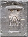
Ordnance Survey Flush Bracket (S9111)
This OS Flush Bracket can be found on the west face of The Schooner Inn. It marks a point 13.362m above mean sea level.
Image: © Adrian Dust
Taken: 25 Sep 2017
0.19 miles
9
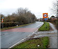
30mph speed limit on the southern approach to Cosmeston
The 40mph speed limit on the B4267 from Sully reduces to 30mph at the approach to the residential part of Cosmeston.
Image: © Jaggery
Taken: 2 Dec 2012
0.20 miles
10
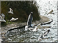
Cosmeston Lakes - gulls at east lake
Lesser black-backed and Black-headed gulls scavenge for scraps from visitors. There are large numbers of both species here as well as Mute Swans.
Image: © Mick Lobb
Taken: 24 Mar 2009
0.20 miles