1
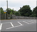
Heol y Frenhines, Dinas Powys
No through road signs faces the A4055 junction.
Image: © Jaggery
Taken: 11 Aug 2016
0.11 miles
2
Southra, Dinas Powys Common
Southra runs from Station Road through Dinas Powys Common. This view is looking southwestwards from near the Station Road end.
Image: © Jaggery
Taken: 16 Jun 2010
0.13 miles
3
Barry Road railway bridge, Dinas Powys
Viewed from Dinas Powys station. The bridge carries the A4055, here named Barry Road.
Image: © Jaggery
Taken: 16 Jun 2010
0.14 miles
4
Cardiff Road pelican crossing, Dinas Powys
The St Cadoc's Avenue junction is on the left. Chambers Dictionary states that pelican in this context is adapted from "pedestrian light controlled crossing".
Image: © Jaggery
Taken: 11 Aug 2016
0.15 miles
5
Cardiff Road in Dinas Powys towards Barry
Looking south along the A4055 Cardiff Road past the St Cadoc's Avenue junction.
Image: © Jaggery
Taken: 11 Aug 2016
0.16 miles
6
Houses at the southern end of St Cadoc's Avenue, Dinas Powys
The backs of the houses are alongside East Brook.
Image: © Jaggery
Taken: 11 Aug 2016
0.17 miles
7
St Winifred's Close, Dinas Powys
Cul-de-sac viewed across St Cadoc's Avenue.
Image: © Jaggery
Taken: 11 Aug 2016
0.18 miles
8
Ordnance Survey Cut Mark
This OS cut mark can be found on the west parapet of the railway bridge. It marks a point 22.260m above mean sea level.
Image: © Adrian Dust
Taken: 16 Mar 2018
0.18 miles
9
Telecoms cabinet on a Dinas Powys corner
On the corner of St Cadoc's Avenue and St Winifred's Close.
Image: © Jaggery
Taken: 11 Aug 2016
0.19 miles
10
Barry Road railway bridge, Dinas Powys
The bridge carries the A4055 over the Vale of Glamorgan Line railway near Dinas Powys station.
Image: © Jaggery
Taken: 11 Aug 2016
0.19 miles


