
IMAGES TAKEN NEAR TO
Llandyfrig Close, DINAS POWYS, CF64 4PP
Introduction
This page details the photographs taken nearby to Llandyfrig Close, CF64 4PP by members of the Geograph project.
The Geograph project started in 2005 with the aim of publishing, organising and preserving representative images for every square kilometre of Great Britain, Ireland and the Isle of Man.

There are currently over 7.5m images from over14,400 individuals and you can help contribute to the project by visiting https://www.geograph.org.uk
Image Map
Images are licensed for reuse under creativecommons.org/licenses/by-sa/2.0
Notes
- Clicking on the map will re-center to the selected point.
- The higher the marker number, the further away the image location is from the centre of the postcode.
Image Listing (73 Images Found)
Images are licensed for reuse under creativecommons.org/licenses/by-sa/2.0
Image
Details
Distance
1
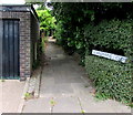
Footpath to Llandyfrig Close, Dinas Powys
From the north side of Cardigan Close.
Image: © Jaggery
Taken: 5 Aug 2016
0.02 miles
2
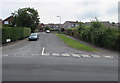
Western end of Cardigan Close, Dinas Powys
Viewed across Castle Drive. The name sign on the left shows that Cardigan Close leads to Llandyfrig Close, Cardigan Road and Carmarthen Road.
Image: © Jaggery
Taken: 5 Aug 2016
0.03 miles
3
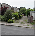
Footpath to Cardigan Road houses, Dinas Powys
From Cardigan Close to the backs of houses on the west side of Cardigan Road.
Image: © Jaggery
Taken: 5 Aug 2016
0.05 miles
4
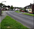
Bend in Castle Drive, Dinas Powys
Past the Conway Close junction.
Image: © Jaggery
Taken: 5 Aug 2016
0.06 miles
5
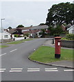
Queen Elizabeth II pillarbox on a Dinas Powys corner
On the corner of Castle Drive and Conway Close in Dinas Powys.
Image: © Jaggery
Taken: 5 Aug 2016
0.06 miles
6
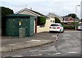
Electricity substation on a Dinas Powys corner
The large dark green cabinet on the corner of Cardigan Road and Raglan Close
is a Western Power Distribution electricity substation. Its identifier is S/S 512882.
Image: © Jaggery
Taken: 5 Aug 2016
0.07 miles
7
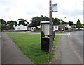
Castle Drive bus stop, Dinas Powys
Between the corner of Denbigh Road and the corner of Conway Close (ahead).
The sign shows (bus route) 87 to Culverhouse Cross.
Image: © Jaggery
Taken: 5 Aug 2016
0.08 miles
8
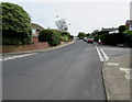
East along Raglan Close, Dinas Powys
The Cardigan Road junction is on the left. The Llandilo Close junction http://www.geograph.org.uk/photo/5083279 is on the right.
Image: © Jaggery
Taken: 5 Aug 2016
0.08 miles
9
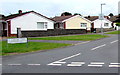
Conway Close bungalows, Dinas Powys
Viewed across Castle Drive. The street name sign shows that Conway Close
leads to Caerleon Road, Rhuddlan Way, Criccieth Court and Caerphilly Close.
Image: © Jaggery
Taken: 5 Aug 2016
0.08 miles
10
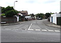
Cardigan Road, Dinas Powys
Connecting Cardigan Close on this side with Raglan Close out of shot 75 metres from the camera.
Image: © Jaggery
Taken: 5 Aug 2016
0.08 miles