
IMAGES TAKEN NEAR TO
The Gables, The Southra, DINAS POWYS, CF64 4DN
Introduction
This page details the photographs taken nearby to The Gables, The Southra, CF64 4DN by members of the Geograph project.
The Geograph project started in 2005 with the aim of publishing, organising and preserving representative images for every square kilometre of Great Britain, Ireland and the Isle of Man.

There are currently over 7.5m images from over14,400 individuals and you can help contribute to the project by visiting https://www.geograph.org.uk
Image Map
Images are licensed for reuse under creativecommons.org/licenses/by-sa/2.0
Notes
- Clicking on the map will re-center to the selected point.
- The higher the marker number, the further away the image location is from the centre of the postcode.
Image Listing (38 Images Found)
Images are licensed for reuse under creativecommons.org/licenses/by-sa/2.0
Image
Details
Distance
1
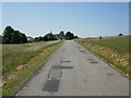
Southra, Dinas Powys Common
Southra runs from Station Road through Dinas Powys Common. This view is looking southwestwards from near the Station Road end.
Image: © Jaggery
Taken: 16 Jun 2010
0.02 miles
2
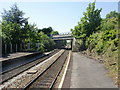
Barry Road railway bridge, Dinas Powys
Viewed from Dinas Powys station. The bridge carries the A4055, here named Barry Road.
Image: © Jaggery
Taken: 16 Jun 2010
0.07 miles
3
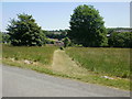
Mown grassy track, Dinas Powys Common
A track covered with short grass heads through long grass from Southra http://www.geograph.org.uk/photo/1918850 towards Station Road.
Image: © Jaggery
Taken: 16 Jun 2010
0.11 miles
4
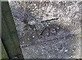
Ordnance Survey Cut Mark
This OS cut mark can be found on the west parapet of the railway bridge. It marks a point 22.260m above mean sea level.
Image: © Adrian Dust
Taken: 16 Mar 2018
0.11 miles
5
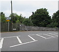
Barry Road railway bridge, Dinas Powys
The bridge carries the A4055 over the Vale of Glamorgan Line railway near Dinas Powys station.
Image: © Jaggery
Taken: 11 Aug 2016
0.12 miles
6
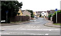
Heol y Frenhines, Dinas Powys
No through road signs faces the A4055 junction.
Image: © Jaggery
Taken: 11 Aug 2016
0.12 miles
7
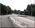
Cardiff Road pelican crossing, Dinas Powys
The St Cadoc's Avenue junction is on the left. Chambers Dictionary states that pelican in this context is adapted from "pedestrian light controlled crossing".
Image: © Jaggery
Taken: 11 Aug 2016
0.15 miles
8
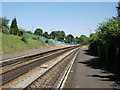
Dinas Powys railway station
The view from the south west edge of the station.
Image: © Jaggery
Taken: 16 Jun 2010
0.15 miles
9
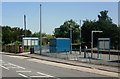
Entrance to Dinas Powys railway station
Viewed from Cardiff Road. The station is on the Vale of Glamorgan line, between Eastbrook and Cadoxton stations.
Image: © Jaggery
Taken: 16 Jun 2010
0.15 miles
10
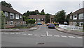
St Winifred's Close, Dinas Powys
Cul-de-sac viewed across St Cadoc's Avenue.
Image: © Jaggery
Taken: 11 Aug 2016
0.16 miles