1
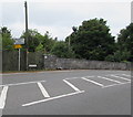
Southra, Dinas Powys Common
Southra runs from Station Road through Dinas Powys Common. This view is looking southwestwards from near the Station Road end.
Image: © Jaggery
Taken: 16 Jun 2010
0.02 miles
2
Barry Road railway bridge, Dinas Powys
Viewed from Dinas Powys station. The bridge carries the A4055, here named Barry Road.
Image: © Jaggery
Taken: 16 Jun 2010
0.07 miles
3
Mown grassy track, Dinas Powys Common
A track covered with short grass heads through long grass from Southra http://www.geograph.org.uk/photo/1918850 towards Station Road.
Image: © Jaggery
Taken: 16 Jun 2010
0.08 miles
4
Ordnance Survey Cut Mark
This OS cut mark can be found on the west parapet of the railway bridge. It marks a point 22.260m above mean sea level.
Image: © Adrian Dust
Taken: 16 Mar 2018
0.10 miles
5
Barry Road railway bridge, Dinas Powys
The bridge carries the A4055 over the Vale of Glamorgan Line railway near Dinas Powys station.
Image: © Jaggery
Taken: 11 Aug 2016
0.11 miles
6
Dinas Powys railway station
The view from the south west edge of the station.
Image: © Jaggery
Taken: 16 Jun 2010
0.14 miles
7
Entrance to Dinas Powys railway station
Viewed from Cardiff Road. The station is on the Vale of Glamorgan line, between Eastbrook and Cadoxton stations.
Image: © Jaggery
Taken: 16 Jun 2010
0.14 miles
8
Heol y Frenhines, Dinas Powys
No through road signs faces the A4055 junction.
Image: © Jaggery
Taken: 11 Aug 2016
0.15 miles
9
Station Road, Dinas Powys
Station Road ascends from the A4055.
Image: © Jaggery
Taken: 11 Aug 2016
0.15 miles
10
Southra, Dinas Powys
Viewed across Station Road. Southra is the road along the southern edge of Dinas Powys Common.
Image: © Jaggery
Taken: 11 Aug 2016
0.15 miles


