
IMAGES TAKEN NEAR TO
Greenfield Avenue, DINAS POWYS, CF64 4BX
Introduction
This page details the photographs taken nearby to Greenfield Avenue, CF64 4BX by members of the Geograph project.
The Geograph project started in 2005 with the aim of publishing, organising and preserving representative images for every square kilometre of Great Britain, Ireland and the Isle of Man.

There are currently over 7.5m images from over14,400 individuals and you can help contribute to the project by visiting https://www.geograph.org.uk
Image Map
Images are licensed for reuse under creativecommons.org/licenses/by-sa/2.0
Notes
- Clicking on the map will re-center to the selected point.
- The higher the marker number, the further away the image location is from the centre of the postcode.
Image Listing (158 Images Found)
Images are licensed for reuse under creativecommons.org/licenses/by-sa/2.0
Image
Details
Distance
1
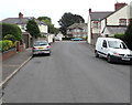
Edith Road towards Greenfield Avenue, Dinas Powys
Looking to the northeast along Edith Road from near the corner of Stacey Road.
Image: © Jaggery
Taken: 18 Aug 2016
0.01 miles
2
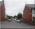
Southwest end of Edith Road, Dinas Powys
Looking to the northeast from Elm Grove Road.
Image: © Jaggery
Taken: 11 Aug 2016
0.03 miles
3
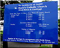
Catholic churches information board in Dinas Powys
On the left here, http://www.geograph.org.uk/photo/5079278 outside St Mary's Catholic Church. The board gives information for St Mary's and for the other church in the Parish, St Joseph's, Penarth. The Parish is part of the Roman Catholic Archdiocese of Cardiff.
Image: © Jaggery
Taken: 18 Aug 2016
0.03 miles
4
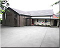
Saint Mary's Catholic Church, Dinas Powys
The church is set back from Edith Road, opposite the Stacey Road junction.
Saint Mary's is part of the Roman Catholic Archdiocese of Cardiff. http://www.geograph.org.uk/photo/5079278 to a broader view.
Image: © Jaggery
Taken: 18 Aug 2016
0.04 miles
5
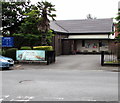
Saint Mary's Catholic Church, Dinas Powys
The church is set back from Edith Road, viewed from the corner of Stacey Road.
Saint Mary's is part of the Roman Catholic Archdiocese of Cardiff. http://www.geograph.org.uk/photo/5079259 to a closer view.
Image: © Jaggery
Taken: 18 Aug 2016
0.04 miles
6
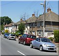
Greenfield Avenue, Dinas Powys
Houses on the east side of Greenfield Avenue, viewed from the Cardiff Road end.
Image: © Jaggery
Taken: 16 Jun 2010
0.04 miles
7
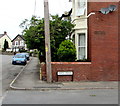
Older and newer Edith Road name signs, Dinas Powys
The older sign on the wall below the satellite dishes has rusted to near illegibility.
Image: © Jaggery
Taken: 18 Aug 2016
0.05 miles
8
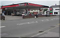
Texaco, Cardiff Road, Dinas Powys
Filling station viewed across the A4055 Cardiff Road. A Spar shop is at the back of the filling station.
Image: © Jaggery
Taken: 11 Aug 2016
0.05 miles
9
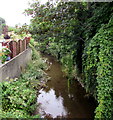
Cadoxton River, Dinas Powys
Flowing towards the camera on the north side of an A4055 Cardiff Road bridge.
About 8km long, the streamlike Cadoxton River is one of the shortest rivers (so named) in Wales.
Image: © Jaggery
Taken: 11 Aug 2016
0.05 miles
10
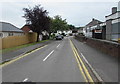
Orchard Crescent, Dinas Powys
Cul-de-sac on the west side of the A4055 Cardiff Road.
Image: © Jaggery
Taken: 11 Aug 2016
0.05 miles