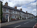
IMAGES TAKEN NEAR TO
Countess Place, PENARTH, CF64 3UJ
Introduction
This page details the photographs taken nearby to Countess Place, CF64 3UJ by members of the Geograph project.
The Geograph project started in 2005 with the aim of publishing, organising and preserving representative images for every square kilometre of Great Britain, Ireland and the Isle of Man.

There are currently over 7.5m images from over14,400 individuals and you can help contribute to the project by visiting https://www.geograph.org.uk
Image Map
Images are licensed for reuse under creativecommons.org/licenses/by-sa/2.0
Notes
- Clicking on the map will re-center to the selected point.
- The higher the marker number, the further away the image location is from the centre of the postcode.
Image Listing (28 Images Found)
Images are licensed for reuse under creativecommons.org/licenses/by-sa/2.0
Image
Details
Distance
1
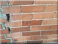
Ordnance Survey Cut Mark
This OS cut mark can be found on No55 Cornerswell Road. It marks a point 36.149m above mean sea level.
Image: © Adrian Dust
Taken: 17 Sep 2021
0.08 miles
2
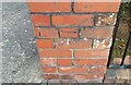
Ordnance Survey Cut Mark
This OS cut mark can be found on the wall of No77 Redlands Road. It marks a point 33.484m above mean sea level.
Image: © Adrian Dust
Taken: 17 Sep 2021
0.11 miles
3
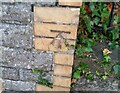
Ordnance Survey Cut Mark
This OS cut mark can be found on the school wall, Stockwell Road. It marks a point 46.128m above mean sea level.
Image: © Adrian Dust
Taken: 17 Sep 2021
0.12 miles
4
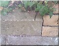
Ordnance Survey Rivet
This OS rivet can be found on the school wall SE side of Stanwell Road. It marks a point 45.418m above mean sea level.
Image: © Adrian Dust
Taken: 17 Sep 2021
0.13 miles
6
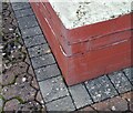
Ordnance Survey Cut Mark
This OS cut mark can be found on No18 Milton Road. It marks a point 37.091m above mean sea level.
Image: © Adrian Dust
Taken: 17 Sep 2021
0.17 miles
7
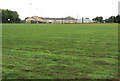
Towards Stanwell Comprehensive School, Penarth
Viewed from the Lavernock Road perimeter railings.
Image: © Jaggery
Taken: 28 Jul 2016
0.18 miles
8
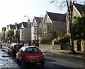
Stanwell Road, Penarth
Houses on the north side of the road.
Image: © Jaggery
Taken: 5 Feb 2010
0.19 miles
9

Stanwell Road houses, Penarth
Near the corner of the B4267 Redlands Road. The red pillarbox http://www.geograph.org.uk/photo/5054488 is Edwardian.
Image: © Jaggery
Taken: 28 Jul 2016
0.19 miles