
IMAGES TAKEN NEAR TO
St. Pauls Avenue, PENARTH, CF64 3PR
Introduction
This page details the photographs taken nearby to St. Pauls Avenue, CF64 3PR by members of the Geograph project.
The Geograph project started in 2005 with the aim of publishing, organising and preserving representative images for every square kilometre of Great Britain, Ireland and the Isle of Man.

There are currently over 7.5m images from over14,400 individuals and you can help contribute to the project by visiting https://www.geograph.org.uk
Image Map
Images are licensed for reuse under creativecommons.org/licenses/by-sa/2.0
Notes
- Clicking on the map will re-center to the selected point.
- The higher the marker number, the further away the image location is from the centre of the postcode.
Image Listing (70 Images Found)
Images are licensed for reuse under creativecommons.org/licenses/by-sa/2.0
Image
Details
Distance
1
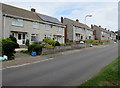
Dinas Road semis, Penarth
Semi-detached houses on the north side of Dinas Road.
Image: © Jaggery
Taken: 5 Aug 2016
0.05 miles
2
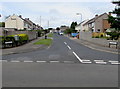
St Peter's Road, Penarth
On the north side of Dinas Road.
Image: © Jaggery
Taken: 5 Aug 2016
0.06 miles
3
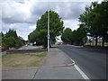
Lavernock Rd, old and new, Penarth
The original track of Lavernock Rd (on the left) has been blocked off, and replaced by a wider road (on the right).
Image: © John Lord
Taken: 6 Jul 2010
0.06 miles
4
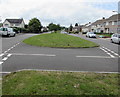
West along Dinas Road, Penarth
Dinas Road is a dual carriageway road with a wide central grass strip.
Image: © Jaggery
Taken: 5 Aug 2016
0.06 miles
5
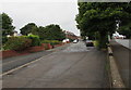
Former route of the B4267 in Penarth
Now a side road, this used to be the route of the B4267 which is now on the right.
Image: © Jaggery
Taken: 28 Jul 2016
0.06 miles
6
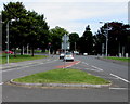
Small grass triangle in Dinas Road, Penarth
Near the eastern end of Dinas Road, where the wide dual carriageway www.geograph.org.uk/photo/5062491
narrows on the approach to the Lavernock Road junction.
Image: © Jaggery
Taken: 5 Aug 2016
0.07 miles
7

Row of brick houses, Lavernock Road, Penarth
Extending for 65 metres from the corner of Hazel Road.
Image: © Jaggery
Taken: 28 Jul 2016
0.07 miles
8
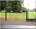
Black school gates, Lavernock Road, Penarth
The gates are at the southwestern perimeter of Stanwell Comprehensive School.
The red notices show FOR EMERGENCY USE ONLY - KEEP CLEAR.
Image: © Jaggery
Taken: 28 Jul 2016
0.07 miles
9
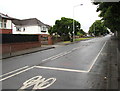
Cycle lane markings on Lavernock Road, Penarth
Viewed from the corner of Victoria Road.
Image: © Jaggery
Taken: 28 Jul 2016
0.07 miles
10
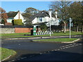
E-bike docking and charging point, Dinas Road
Photographed in 2023, removed in 2024. Part of a larger scheme across Penarth.
Image: © Christine Johnstone
Taken: 10 Nov 2023
0.07 miles