
IMAGES TAKEN NEAR TO
St. Pauls Avenue, PENARTH, CF64 3PQ
Introduction
This page details the photographs taken nearby to St. Pauls Avenue, CF64 3PQ by members of the Geograph project.
The Geograph project started in 2005 with the aim of publishing, organising and preserving representative images for every square kilometre of Great Britain, Ireland and the Isle of Man.

There are currently over 7.5m images from over14,400 individuals and you can help contribute to the project by visiting https://www.geograph.org.uk
Image Map
Images are licensed for reuse under creativecommons.org/licenses/by-sa/2.0
Notes
- Clicking on the map will re-center to the selected point.
- The higher the marker number, the further away the image location is from the centre of the postcode.
Image Listing (68 Images Found)
Images are licensed for reuse under creativecommons.org/licenses/by-sa/2.0
Image
Details
Distance

2

Hazel Road electricity substation, Penarth
The Western Power Distribution electricity substation is located in a brick enclosure at the edge of Penarth Fire Station, on the right here. http://www.geograph.org.uk/photo/5056113 Its identifier is HAZEL RD PENARTH S/S 512268.
Image: © Jaggery
Taken: 28 Jul 2016
0.04 miles
3
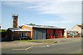
Penarth Fire Station
Penarth Fire Station, Hazel Road, Penarth
Image: © Kevin Hale
Taken: 5 Jun 2007
0.04 miles
4
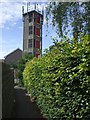
Fire station tower, seen from footpath off Lavernock Rd, Penarth
Image: © John Lord
Taken: 6 Jul 2010
0.04 miles
5

Fire safety banner outside Penarth Fire Station
On the left here. http://www.geograph.org.uk/photo/5056113 Three tips are shown:
1) Test your smoke alarm. 2) Plan your escape. 3) Get out, stay out, dial 999.
Image: © Jaggery
Taken: 28 Jul 2016
0.04 miles
6
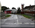
Western end of Hazel Road, Penarth
From Laburnum Way along Hazel Road towards Penarth Fire Station. http://www.geograph.org.uk/photo/5056113
Image: © Jaggery
Taken: 28 Jul 2016
0.05 miles
7
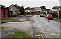
Zigzag yellow markings on Hazel Road, Penarth
Marking a 30 metre long Keep Clear zone outside Penarth Fire Station. http://www.geograph.org.uk/photo/5056107
Image: © Jaggery
Taken: 28 Jul 2016
0.05 miles
8

Penarth Fire Station
Viewed across Hazel Road. Part of the South Wales Fire and Rescue Service, Penarth Fire Station serves the communities of Penarth, Dinas Powys and Sully. Built by Glamorgan Fire Service, this Fire Station opened on May 30th 1960.
Image: © Jaggery
Taken: 28 Jul 2016
0.05 miles
9

Penarth Fire Station and tower
Viewed across Hazel Road. Part of the South Wales Fire and Rescue Service, Penarth Fire Station serves the communities of Penarth, Dinas Powys and Sully. Built by Glamorgan Fire Service, this Fire Station opened on May 30th 1960.
Image: © Jaggery
Taken: 28 Jul 2016
0.05 miles
10
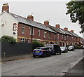
Row of houses, Lavernock Road, Penarth
The houses are alongside a side road, the former route of the B4267.
The B4267 is now a couple of metres out of shot on the right.
Image: © Jaggery
Taken: 28 Jul 2016
0.05 miles