1
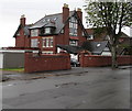
Victoria Road flats, Penarth
A large house on the south side of Victoria Road has been converted to several flats.
Image: © Jaggery
Taken: 28 Jul 2016
0.07 miles
2
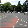
Zigzag markings on Victoria Road, Penarth
The yellow markings define the Keep Clear zone at the southern edge of Stanwell Comprehensive School.
A nearby sign states that the zone is in force on Mondays-Fridays from 8am-9am and from 2pm-3.30pm. Buses are exempted.
Image: © Jaggery
Taken: 28 Jul 2016
0.07 miles
3
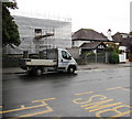
Victoria Road house under wraps, Penarth
Sheeting and scaffolding encase a house in late July 2016.
Image: © Jaggery
Taken: 28 Jul 2016
0.08 miles
4
Monmouth House, Salisbury Close, Penarth
One of three identical blocks of flats on the north side of Victoria Road.
Image: © Christine Johnstone
Taken: 10 Nov 2023
0.10 miles
5
B4267 Lavernock Road south of crossroads, Penarth
The Victoria Road junction is on the left, Dinas Road on the right
Image: © Jaggery
Taken: 28 Jul 2016
0.10 miles
6
Western end of Victoria Road, Penarth
On the east side of the Dinas Road and Lavernock Road crossroads.
Image: © Jaggery
Taken: 5 Aug 2016
0.10 miles
7
Western end of Victoria Road, Penarth
Traffic lights face Victoria Road at the crossroads with the B4267 Lavernock Road and Dinas Road.
Image: © Jaggery
Taken: 28 Jul 2016
0.10 miles
8
Denbigh Court, Penarth
3-storey block of flats between Victoria Road and Salisbury Close.
Image: © Jaggery
Taken: 28 Jul 2016
0.11 miles
9
Two red lights on a Penarth corner
Traffic lights on the corner of the B4267 Lavernock Road (left) and Dinas Road.
Image: © Jaggery
Taken: 28 Jul 2016
0.11 miles
10
Eastern end of Dinas Road, Penarth
Dinas Road ends at traffic lights at the Lavernock Road junction.
Image: © Jaggery
Taken: 5 Aug 2016
0.12 miles


