1
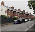
Former route of the B4267 in Penarth
Now a side road, this used to be the route of the B4267 which is now on the right.
Image: © Jaggery
Taken: 28 Jul 2016
0.01 miles
2
Row of brick houses, Lavernock Road, Penarth
Extending for 65 metres from the corner of Hazel Road.
Image: © Jaggery
Taken: 28 Jul 2016
0.02 miles
3
Black school gates, Lavernock Road, Penarth
The gates are at the southwestern perimeter of Stanwell Comprehensive School.
The red notices show FOR EMERGENCY USE ONLY - KEEP CLEAR.
Image: © Jaggery
Taken: 28 Jul 2016
0.03 miles
4
Fire station tower, seen from footpath off Lavernock Rd, Penarth
Image: © John Lord
Taken: 6 Jul 2010
0.04 miles
5
Lavernock Rd, old and new, Penarth
The original track of Lavernock Rd (on the left) has been blocked off, and replaced by a wider road (on the right).
Image: © John Lord
Taken: 6 Jul 2010
0.04 miles
6
Terraced houses, Lavernock Rd, Penarth
Image: © John Lord
Taken: 6 Jul 2010
0.05 miles
7
Row of houses, Lavernock Road, Penarth
The houses are alongside a side road, the former route of the B4267.
The B4267 is now a couple of metres out of shot on the right.
Image: © Jaggery
Taken: 28 Jul 2016
0.05 miles
8
Cycle lane markings on Lavernock Road, Penarth
Viewed from the corner of Victoria Road.
Image: © Jaggery
Taken: 28 Jul 2016
0.06 miles
9
Fire safety banner outside Penarth Fire Station
On the left here. http://www.geograph.org.uk/photo/5056113 Three tips are shown:
1) Test your smoke alarm. 2) Plan your escape. 3) Get out, stay out, dial 999.
Image: © Jaggery
Taken: 28 Jul 2016
0.06 miles
10
Cefn Mably bus stop and shelter, Lavernock Road, Penarth
Located near the Cefn Mably Hotel, http://www.geograph.org.uk/photo/5054452 this bus stop alongside the B4267 Lavernock Road is for buses on Cardiff Bus route 92 to Penarth (St Lukes Avenue) and route 94 to Barry via Sully and Cadoxton.
Image: © Jaggery
Taken: 28 Jul 2016
0.06 miles


