
IMAGES TAKEN NEAR TO
Stanwell Road, PENARTH, CF64 3LR
Introduction
This page details the photographs taken nearby to Stanwell Road, CF64 3LR by members of the Geograph project.
The Geograph project started in 2005 with the aim of publishing, organising and preserving representative images for every square kilometre of Great Britain, Ireland and the Isle of Man.

There are currently over 7.5m images from over14,400 individuals and you can help contribute to the project by visiting https://www.geograph.org.uk
Image Map
Images are licensed for reuse under creativecommons.org/licenses/by-sa/2.0
Notes
- Clicking on the map will re-center to the selected point.
- The higher the marker number, the further away the image location is from the centre of the postcode.
Image Listing (136 Images Found)
Images are licensed for reuse under creativecommons.org/licenses/by-sa/2.0
Image
Details
Distance
1
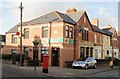
Wood Street Post Office, Penarth
Post office, built in 1999, on the corner of Wood Street and Cornerswell Road.
Image: © Jaggery
Taken: 5 Feb 2010
0.03 miles
2
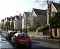
Stanwell Road, Penarth
Houses on the north side of the road.
Image: © Jaggery
Taken: 5 Feb 2010
0.03 miles
3
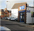
O'Neils Car Sales, Cornerswell Road, Penarth
The premises at 3 Cornerswell Road were formerly occupied by Motortrade Direct Ltd of Penarth.
In the background is Wood Street post office. http://www.geograph.org.uk/photo/1972519
Image: © Jaggery
Taken: 5 Feb 2010
0.06 miles
4
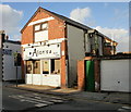
Alan's Unisex Salon, Penarth
Hairdressers on Cornerswell Road, next door to O'Neils Car Sales. http://www.geograph.org.uk/photo/1972534
Image: © Jaggery
Taken: 5 Feb 2010
0.06 miles
5
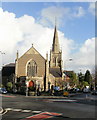
Trinity Methodist Church, Penarth
Located on the corner of Woodland Place and Stanwell Road. Construction work on the church began in 1899. It opened for worship in 1901, replacing a prefabricated, corrugated iron ‘Tin Church’, erected here in 1887.
Image: © Jaggery
Taken: 5 Feb 2010
0.06 miles
6
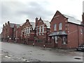
Victoria School
Victoria Primary School, Penarth.
Image: © Alan Hughes
Taken: 13 Jan 2016
0.07 miles
7
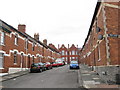
Machen Street, Penarth
Viewed from the junction with Rudry Street.
Image: © Gareth James
Taken: 21 Jul 2010
0.07 miles
8
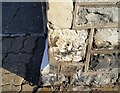
Ordnance Survey Cut Mark
This eroded badly OS cut mark can be found on No12 Machen Street. It marks a point 44.504m above mean sea level.
Image: © Adrian Dust
Taken: 17 Sep 2021
0.08 miles
9
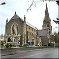
Trinity Methodist Church, Penarth
Trinity Methodist Church, Stanwell Road, Penarth.
Image: © Alan Hughes
Taken: 13 Jan 2016
0.11 miles
10

All Saints Church, Penarth
All Saints is in the middle of a green rectangle known as Victoria Square.
The church is part of the Church in Wales Diocese of Llandaff.
Image: © Jaggery
Taken: 28 Jul 2016
0.12 miles