1
St.Aubin's Nursery
St.Aubin's Nursery School, Penarth.
Image: © Alan Hughes
Taken: 8 Aug 2016
0.11 miles
2
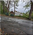
Dark green telecoms cabinets, Archer Road, Penarth
Viewed from the southern end of Station Road.
Image: © Jaggery
Taken: 26 Oct 2021
0.12 miles
3
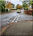
Junction of Station Road and Archer Road, Penarth
From the right (north), Station Road joins Archer Road.
Image: © Jaggery
Taken: 26 Oct 2021
0.12 miles
4
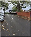
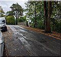
Southern end of Station Road, Penarth
Station Road ascends towards the Archer Road junction.
Fallen leaves are on the road surface and pavement on October 26th 2021.
Image: © Jaggery
Taken: 26 Oct 2021
0.12 miles
5
Entrance to St Aubin Nurseries, Penarth
Children's nurseries entrance viewed across Station Road.
Image: © Jaggery
Taken: 26 Oct 2021
0.13 miles
6
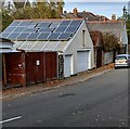
Rooftop solar panels, Station Road, Penarth
Ideally located on a south facing roof.
Image: © Jaggery
Taken: 5 Nov 2021
0.13 miles
7
Ordnance Survey Cut Mark
This OS cut mark can be found on the south parapet of the railway bridge. It marks a point 40.819m above mean sea level.
Image: © Adrian Dust
Taken: 25 Sep 2017
0.13 miles
8
Footpath beside Sully Terrace, Penarth
This was the route of the former Cadoxton to Penarth railway line, and this was the approximate site of Alberta Place station.
Image: © Gareth James
Taken: 9 Jun 2010
0.13 miles
9
Ordnance Survey Cut Mark
This OS cut mark can be found on the wall of No118 Westbourne Road. It marks a point 27.383m above mean sea level.
Image: © Adrian Dust
Taken: 25 Sep 2017
0.13 miles
10
East along Archer Road towards a former railway bridge, Penarth
The bridge carries Archer Road over a path on the route of a dismantled railway.
Image: © Jaggery
Taken: 26 Oct 2021
0.13 miles


