1
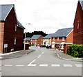
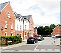
Heol y Brenin, Lower Penarth
Eastwards along Heol y Brenin from Rhos Ddu.
Image: © Jaggery
Taken: 5 Aug 2016
0.01 miles
2
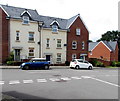
Heol y Brenin, Lower Penarth
From near the corner of Dinas Road, looking northwest past the right turn into Tal y Bryn. http://www.geograph.org.uk/photo/5062594
Street names in this recently-built part of Lower Penarth are in Welsh only.
Heol y Brenin is Welsh for King's Road.
Image: © Jaggery
Taken: 5 Aug 2016
0.02 miles
3
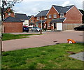
D?l Gwartheg, Lower Penarth
On the north side of Heol y Brenin. Dôl Gwartheg is Welsh for cattle meadow.
Image: © Jaggery
Taken: 5 Aug 2016
0.03 miles
4
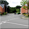
Cwrt Tŷ Mawr, Lower Penarth
Cul-de-sac viewed from the corner of Rhos Ddu.
Image: © Jaggery
Taken: 5 Aug 2016
0.03 miles
5
Cars and houses, Rhos Ddu, Lower Penarth
Viewed from the corner of Heol y Brenin.
Image: © Jaggery
Taken: 5 Aug 2016
0.04 miles
6
Tŷ Uchaf houses, Lower Penarth
Viewed from Heol y Brenin. Tŷ Uchaf is a cul-de-sac on the south side of Tal y Bryn.
Image: © Jaggery
Taken: 5 Aug 2016
0.05 miles
7
Northern end of Rhos Ddu, Lower Penarth
From the corner of Heol y Brenin.
Image: © Jaggery
Taken: 5 Aug 2016
0.05 miles
8
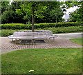
Metal bench around a tree, Lower Penarth
On the pavement on the west side of this http://www.geograph.org.uk/photo/5062635 roundabout.
Image: © Jaggery
Taken: 5 Aug 2016
0.06 miles
9
Tal y Bryn, Lower Penarth
Cul-de-sac on the east side of Heol y Brenin.
Image: © Jaggery
Taken: 5 Aug 2016
0.06 miles
10
Young tree on a Lower Penarth roundabout
On the roundabout at the junction of Dinas Road, Heol y Brenin and Heol Tre Forys, viewed on August 5th 2016. This young tree is an excellent subject for a time lapse study.
Any local volunteers for a similar view in August 2017, August 2018, August 2019... ?
Image: © Jaggery
Taken: 5 Aug 2016
0.07 miles


