
IMAGES TAKEN NEAR TO
Victoria Road, PENARTH, CF64 3EF
Introduction
This page details the photographs taken nearby to Victoria Road, CF64 3EF by members of the Geograph project.
The Geograph project started in 2005 with the aim of publishing, organising and preserving representative images for every square kilometre of Great Britain, Ireland and the Isle of Man.

There are currently over 7.5m images from over14,400 individuals and you can help contribute to the project by visiting https://www.geograph.org.uk
Image Map
Images are licensed for reuse under creativecommons.org/licenses/by-sa/2.0
Notes
- Clicking on the map will re-center to the selected point.
- The higher the marker number, the further away the image location is from the centre of the postcode.
Image Listing (231 Images Found)
Images are licensed for reuse under creativecommons.org/licenses/by-sa/2.0
Image
Details
Distance
1

Victoria Lane, Penarth
On the south side of Victoria Road.
Image: © Jaggery
Taken: 28 Jul 2016
0.01 miles
2

Path towards All Saints Church, Penarth
From the corner of Victoria Road and Victoria Square. The Parish Hall is in the background.
The church http://www.geograph.org.uk/photo/5053179 is out of shot behind it.
Image: © Jaggery
Taken: 28 Jul 2016
0.02 miles
3

Welcome to All Saints in the Parish of Penarth
The board is here. http://www.geograph.org.uk/photo/5053181
Image: © Jaggery
Taken: 28 Jul 2016
0.02 miles
4
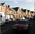
Station Road, Penarth
Houses on the east side of Station Road, viewed from near the north end of the road, adjacent to Station Approach.
Image: © Jaggery
Taken: 5 Feb 2010
0.02 miles
5
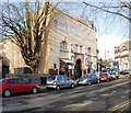
The Paget Rooms, Penarth
A concert hall located on Victoria Road, the Paget Rooms were built in 1906 on land leased from the Earl of Plymouth.
Image: © Jaggery
Taken: 5 Feb 2010
0.02 miles
6

Westbourne Nursery and Junior school, Penarth
Occupying a triangular site between Victoria Road (on this side) and Westbourne Road. Established in 1896, Westbourne School is an independent, co-educational school for children aged 3-18. The Senior School and Sixth Form site is in Hickman Road, Penarth.
Image: © Jaggery
Taken: 28 Jul 2016
0.03 miles
7

Westbourne Road, Penarth
South from Victoria Road.
Image: © Jaggery
Taken: 28 Jul 2016
0.04 miles
8
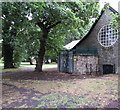
All Saints electricity substation, Penarth
The Western Power Distribution electricity substation is built into a wall of All Saints Parish Hall.
Its identifier is ALL SAINTS PENARTH S/S 512247.
Image: © Jaggery
Taken: 28 Jul 2016
0.04 miles
9
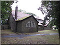
All Saints Parish Hall, Penarth
Located on the NE side of the church http://www.geograph.org.uk/photo/5053179 the hall was built in 1906,
designed by Penarth architect John Coates Carter. Grade II listed in 1990.
Image: © Jaggery
Taken: 28 Jul 2016
0.05 miles
10

Cwrt-y-Vil Road, Penarth
On the south side of Victoria Road.
Image: © Jaggery
Taken: 28 Jul 2016
0.05 miles