
IMAGES TAKEN NEAR TO
Alberta Place, PENARTH, CF64 3DR
Introduction
This page details the photographs taken nearby to Alberta Place, CF64 3DR by members of the Geograph project.
The Geograph project started in 2005 with the aim of publishing, organising and preserving representative images for every square kilometre of Great Britain, Ireland and the Isle of Man.

There are currently over 7.5m images from over14,400 individuals and you can help contribute to the project by visiting https://www.geograph.org.uk
Image Map
Images are licensed for reuse under creativecommons.org/licenses/by-sa/2.0
Notes
- Clicking on the map will re-center to the selected point.
- The higher the marker number, the further away the image location is from the centre of the postcode.
Image Listing (71 Images Found)
Images are licensed for reuse under creativecommons.org/licenses/by-sa/2.0
Image
Details
Distance
1
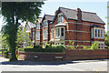
Plymouth Road, Penarth
Some of the substantial Victorian villas that line Plymouth Road, which stretches south from Penarth's town centre, can be seen in this view at the junction with Alberta Place.
Image: © Stephen McKay
Taken: 26 Jun 2018
0.03 miles
2
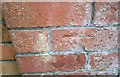
Ordnance Survey Cut Mark
This OS cut mark can be found on the wall of No108 Plymouth Road. It marks a point 42.666m above mean sea level.
Image: © Adrian Dust
Taken: 25 Sep 2017
0.04 miles
3
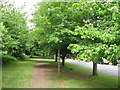
Footpath beside Sully Terrace, Penarth
This was the route of the former Cadoxton to Penarth railway line, and this was the approximate site of Alberta Place station.
Image: © Gareth James
Taken: 9 Jun 2010
0.05 miles
4
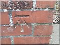
Ordnance Survey Cut Mark
This OS cut mark can be found on the wall of No118 Westbourne Road. It marks a point 27.383m above mean sea level.
Image: © Adrian Dust
Taken: 25 Sep 2017
0.07 miles
5
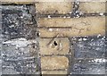
Ordnance Survey Cut Mark
This OS cut mark can be found on the wall of No83 Plymouth Road. It marks a point 31.590m above mean sea level.
Image: © Adrian Dust
Taken: 25 Sep 2017
0.09 miles
6
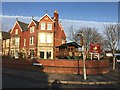
Hazlehurst Nursery
Hazlehurst Children's Nursery, Plymouth Road, Penarth.
Image: © Alan Hughes
Taken: 17 Feb 2017
0.09 miles
7
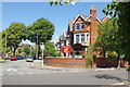
Hazelhurst Children's Nursery, Penarth
Hazelhurst Nursery opened in 1990 and occupies a large house on the corner of Plymouth Road and Raisdale Road.
Image: © Stephen McKay
Taken: 26 Jun 2018
0.09 miles
8
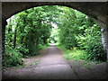
Cycle path beyond Raisdale Road bridge, Penarth
On the route of the former Cadoxton to Penarth railway line.
Image: © Gareth James
Taken: 9 Jun 2010
0.10 miles
9
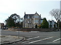
Raisdale House, Penarth
Grade II listed building on the corner of Raisdale Road and Alberta Road. Previously the Raisdale Hotel, the building is now divided into seven 2- and 3-bedroom apartments.
Image: © Jaggery
Taken: 24 Nov 2010
0.13 miles
10
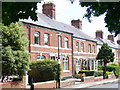
Sully Terrace
Brick terraced cottages in Penarth. These face the former coastal rail track to Barry which ran south from Penarth station.
Image: © Colin Smith
Taken: 7 Jun 2008
0.13 miles