1
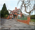
Holm House, Marine Parade, Penarth
Image: © John Lord
Taken: 6 Jul 2010
0.06 miles
2
Ordnance Survey Cut Mark
This OS cut mark can be found on the wall of No83 Plymouth Road. It marks a point 31.590m above mean sea level.
Image: © Adrian Dust
Taken: 25 Sep 2017
0.07 miles
3
Floral mound, Cliff Road, Penarth
The mound is at the top of Cliff Hill, alongside the start/end of Cliff Road. It is enclosed by a foot-rail.
A sloping rectangular area is used for a floral display. Today, late November, the display is well past its best !
Image: © Jaggery
Taken: 24 Nov 2010
0.07 miles
4
Top of Cliff Hill, Penarth
At the top of the climb up from The Esplanade, walkers have the choice of going inland along Cliff Road's pavement on the right, or a cliff-top path on the left.
Image: © Jaggery
Taken: 24 Nov 2010
0.07 miles
5
South Lodge, Windsor Gardens, Penarth
The lodge, dating from 1881, is located on the north side of Cliff Hill, at the southern entrance to Windsor Gardens. http://www.geograph.org.uk/photo/2192215
Image: © Jaggery
Taken: 24 Nov 2010
0.07 miles
6
Ordnance Survey Cut Mark
This OS cut mark can be found on the wall east side of Cliff Hill. It marks a point 25.739m above mean sea level.
Image: © Adrian Dust
Taken: 25 Sep 2017
0.08 miles
7
Entrance to Windsor Gardens, Penarth
Image: © Ruth Sharville
Taken: 7 Feb 2009
0.08 miles
8
Ordnance Survey Cut Mark
This OS cut mark can be found on the wall of No108 Plymouth Road. It marks a point 42.666m above mean sea level.
Image: © Adrian Dust
Taken: 25 Sep 2017
0.09 miles
9
Hedge above Cliff Hill, Penarth
Image: © David Martin
Taken: 1 Mar 2019
0.10 miles
10
Footpath beside Sully Terrace, Penarth
This was the route of the former Cadoxton to Penarth railway line, and this was the approximate site of Alberta Place station.
Image: © Gareth James
Taken: 9 Jun 2010
0.10 miles


