1
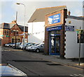
Machen Street, Penarth
Viewed from the junction with Rudry Street.
Image: © Gareth James
Taken: 21 Jul 2010
0.05 miles
2
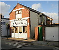
NE end of Coleridge Avenue, Penarth
Viewed across Wordsworth Avenue from the edge of St Joseph's RC church. http://www.geograph.org.uk/photo/3345867
Image: © Jaggery
Taken: 9 Dec 2012
0.06 miles
3
Ordnance Survey Cut Mark
This eroded badly OS cut mark can be found on No12 Machen Street. It marks a point 44.504m above mean sea level.
Image: © Adrian Dust
Taken: 17 Sep 2021
0.06 miles
4
Glamorgan Motors Llandough Service Station, Penarth
Located on the corner of Grove Terrace and Bute Terrace (ahead). Despite the name of the service station, this location is in Penarth, about a mile from the Llandough boundary. http://www.geograph.org.uk/photo/3325493
Image: © Jaggery
Taken: 9 Dec 2012
0.07 miles
5
Victoria School
Victoria Primary School, Penarth.
Image: © Alan Hughes
Taken: 13 Jan 2016
0.07 miles
6
Wood Street Post Office, Penarth
Post office, built in 1999, on the corner of Wood Street and Cornerswell Road.
Image: © Jaggery
Taken: 5 Feb 2010
0.08 miles
7
St. Joseph's RC church, Penarth
The Roman Catholic church is aligned exactly W-E along the north side of Wordsworth Avenue.
It was built in 1914-1915 to replace the original mid-Victorian RC church elsewhere in Penarth.
http://www.geograph.org.uk/photo/3345872 to another view
Image: © Jaggery
Taken: 9 Dec 2012
0.09 miles
8
West along West Terrace, Penarth
From the corner of Dingle Road.
Image: © Jaggery
Taken: 28 Jul 2016
0.09 miles
9
O'Neils Car Sales, Cornerswell Road, Penarth
The premises at 3 Cornerswell Road were formerly occupied by Motortrade Direct Ltd of Penarth.
In the background is Wood Street post office. http://www.geograph.org.uk/photo/1972519
Image: © Jaggery
Taken: 5 Feb 2010
0.09 miles
10
Alan's Unisex Salon, Penarth
Hairdressers on Cornerswell Road, next door to O'Neils Car Sales. http://www.geograph.org.uk/photo/1972534
Image: © Jaggery
Taken: 5 Feb 2010
0.09 miles


