1
Glamorgan Motors Llandough Service Station, Penarth
Located on the corner of Grove Terrace and Bute Terrace (ahead). Despite the name of the service station, this location is in Penarth, about a mile from the Llandough boundary. http://www.geograph.org.uk/photo/3325493
Image: © Jaggery
Taken: 9 Dec 2012
0.03 miles
2
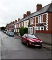
West along West Terrace, Penarth
From the corner of Dingle Road.
Image: © Jaggery
Taken: 28 Jul 2016
0.05 miles
3
Houses on the north side of West Terrace, Penarth
Looking west from Dingle Road.
Image: © Jaggery
Taken: 28 Jul 2016
0.06 miles
4
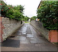
Bute Lane, Penarth
South along Bute Lane from the corner of Dingle Road and West Terrace.
Image: © Jaggery
Taken: 28 Jul 2016
0.06 miles
5
St. Joseph's RC church, Penarth
The Roman Catholic church is aligned exactly W-E along the north side of Wordsworth Avenue.
It was built in 1914-1915 to replace the original mid-Victorian RC church elsewhere in Penarth.
http://www.geograph.org.uk/photo/3345872 to another view
Image: © Jaggery
Taken: 9 Dec 2012
0.07 miles
6
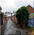
Lane towards Fairfield Road, Penarth
From Dingle Road near Dingle Road railway station.
Image: © Jaggery
Taken: 28 Jul 2016
0.07 miles
7
Ordnance Survey Cut Mark
This OS cut mark can be found on No2 West Terrace. It marks a point 39.176m above mean sea level.
Image: © Adrian Dust
Taken: 17 Sep 2021
0.07 miles
8
SE corner of St. Joseph's RC church, Penarth
This is the Wordsworth Avenue / Fairfield Road corner of the Roman Catholic church built in 1914-1915 to replace the original mid-Victorian RC church elsewhere in Penarth. http://www.geograph.org.uk/photo/3345867 to another view.
Image: © Jaggery
Taken: 9 Dec 2012
0.08 miles
9
Warning sign - School/Ysgol - on a Penarth corner
The bilingual (English/Welsh) sign is on the corner of Bute Lane and Dingle Road.
Image: © Jaggery
Taken: 28 Jul 2016
0.08 miles
10
Monolingual name sign, West Terrace, Penarth
The sign shows the English West Terrace though the council name (Vale of Glamorgan/Bro Morgannwg) is in English and Welsh. In 2016, many street name signs in Wales are in both Welsh and English, though many others are in Welsh only, or, as here, in English only.
Image: © Jaggery
Taken: 28 Jul 2016
0.08 miles


