1
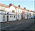
Bridge Street Cogan
Image: © Roy Hughes
Taken: 8 Jul 2021
0.04 miles
2
Bridge Street, Penarth
The NW side of the street, viewed from the Windsor Road end.
Image: © Jaggery
Taken: 24 Nov 2010
0.05 miles
3
Railway bridge, Windsor Road, Penarth
Viewed from the corner of Bridge Street.
The bridge, with a rather faded advert for Brains Dark (ale),carries a single-track railway line above Windsor Road. The railway route is from Cogan Junction to Dingle Road and Penarth stations.
Image: © Jaggery
Taken: 24 Nov 2010
0.05 miles
4
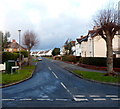
Lone house, Windsor Road, Penarth
In contrast with the long rows of houses on the other side of the road, the NE side of Windsor Road in this area, adjacent to a railway line, has only this one house along a 250 metre section. The strip of land without houses is used for allotments.
Image: © Jaggery
Taken: 24 Nov 2010
0.05 miles
5
Ordnance Survey Cut Mark
This OS cut mark can be found on the SW buttress of the railway bridge on Windsor Road. It marks a point 20.879m above mean sea level.
Image: © Adrian Dust
Taken: 17 Sep 2021
0.07 miles
6
Hewell Street, Cogan
Houses on the north side of Hewell Street, viewed from the corner of Pill Street.
Part of Cogan Coronation Club http://www.geograph.org.uk/photo/2185194 is on the left.
Image: © Jaggery
Taken: 24 Nov 2010
0.08 miles
7
The Cogan pub to let, Cogan, Penarth
Located on the corner of Pill Street and Hewell Street. The To Let sign on the building is for Admiral Taverns, an independent tenanted and leased pub company, which suggests that the pub is to let as a going concern.
Image: © Jaggery
Taken: 24 Nov 2010
0.08 miles
8
Railway Bridge
Cardiff to Penarth railway bridge at Cogan.
Image: © Alan Hughes
Taken: 4 Apr 2016
0.08 miles
9
Middle section of Dryden Road, Penarth
These houses face Fairfield Primary School http://www.geograph.org.uk/photo/3345776
Image: © Jaggery
Taken: 9 Dec 2012
0.10 miles
10
Tennyson Road, Penarth
Looking north from Wordsworth Avenue.
Image: © Jaggery
Taken: 9 Dec 2012
0.11 miles


