
IMAGES TAKEN NEAR TO
Stanwell Road, PENARTH, CF64 2EZ
Introduction
This page details the photographs taken nearby to Stanwell Road, CF64 2EZ by members of the Geograph project.
The Geograph project started in 2005 with the aim of publishing, organising and preserving representative images for every square kilometre of Great Britain, Ireland and the Isle of Man.

There are currently over 7.5m images from over14,400 individuals and you can help contribute to the project by visiting https://www.geograph.org.uk
Image Map
Images are licensed for reuse under creativecommons.org/licenses/by-sa/2.0
Notes
- Clicking on the map will re-center to the selected point.
- The higher the marker number, the further away the image location is from the centre of the postcode.
Image Listing (270 Images Found)
Images are licensed for reuse under creativecommons.org/licenses/by-sa/2.0
Image
Details
Distance
1
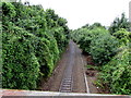
Railway towards Dingle Road station, Penarth
Viewed from Stanwell Road bridge looking along the Penarth branch of the Vale of Glamorgan Line.
Dingle Road station is nearly 600 metres ahead.
Penarth railway station http://www.geograph.org.uk/photo/5096453 is below the other side of the bridge.
Image: © Jaggery
Taken: 28 Jul 2016
0.02 miles
2
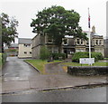
West House, Penarth
Penarth Town Council offices set back from the north side of Stanwell Road.
Image: © Jaggery
Taken: 28 Jul 2016
0.04 miles
3
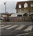
Penarth Conservative Club, 15 Stanwell Road, Penarth
Text at the bottom of the nameboard is STRICTLY MEMBERS ONLY.
Image: © Jaggery
Taken: 20 Nov 2019
0.05 miles
4
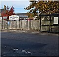
Wooden perimeter fence, Stanwell Road, Penarth
The nameboard shows PENARTH CONSERVATIVE CLUB LTD
Image: © Jaggery
Taken: 5 Nov 2021
0.06 miles
5
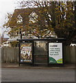
How many miles since your last eye test? Stanwell Road, Penarth
Specsavers advert on display on a Stanwell Road bus shelter on November 20th 2019.
Image: © Jaggery
Taken: 20 Nov 2019
0.06 miles
6
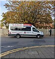
Westbourne School minibus, Penarth
Travelling east on Stanwell Road in November 2021.
Image: © Jaggery
Taken: 5 Nov 2021
0.06 miles
7
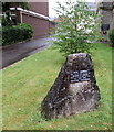
Town twinning plaque, Penarth
Located here http://www.geograph.org.uk/photo/5094705 in front of West House. The plaque was unveiled by Monsieur A.Kervella Mayor of Saint-Pol-de-Léon (Brittany, France) on July 7th 1990 to mark the twentieth anniversary of the twinning of the towns.
Image: © Jaggery
Taken: 28 Jul 2016
0.06 miles
8
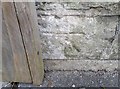
Ordnance Survey Cut Mark
This OS cut mark can be found on the north parapet of the railway bridge. It marks a point 45.458m above mean sea level.
Image: © Adrian Dust
Taken: 25 Sep 2017
0.06 miles
9
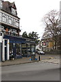
Scottwroe, 10 Royal Buildings, Stanwell Road, Penarth
Scottwroe Hearing Aid Centre & Earwax Clinic is on the right.
Rowleys of Penarth (gifts, jewellery, watches, repairs etc) is on the left.
Image: © Jaggery
Taken: 20 Nov 2019
0.07 miles
10
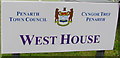
Penarth Civic Insignia and Crest
Depicted on the name sign for West House, Penarth Town Council's offices. http://www.geograph.org.uk/photo/5094705
The Welsh motto Cynghori er Llesiant means Counsel for Benefit (or Gain).
The town crest was drawn by the town's architect in 1875 from a detailed brief prepared by the Town Board. It shows a bear's head above a shield supported by two standing bears. The shield depicts contains a Welsh Red Dragon to denote that the town is in Wales and a sailing vessel symbolising Penarth's long association with sea commerce.
The reference to bears is from a literal translation of Penarth. In Welsh, arth is bear and pen is head. Although that used to be the accepted derivation of the town's name, some modern scholars have suggested that the name is a shortened form of Pen-y-garth, where garth means cliff, hence head of the cliff or cliff top(s).
Image: © Jaggery
Taken: 28 Jul 2016
0.07 miles