1
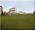
Penarth Head Lane, Penarth
Looking along Penarth Head Lane in the direction of Clive Place. The tower in the middle distance is part of St Augustine's Church. http://www.geograph.org.uk/photo/1952171
Image: © Jaggery
Taken: 24 Nov 2010
0.02 miles
2
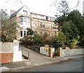
Penarth : SE end of Uppercliff Drive
Looking along Uppercliff Drive towards houses on Uppercliff Close.
Image: © Jaggery
Taken: 24 Nov 2010
0.02 miles
3
Osborne, Clive Crescent, Penarth
A side view of a modern apartment building named Osborne located at 7 Clive Crescent, about 50 metres west of the Bristol Channel shoreline.
Image: © Jaggery
Taken: 24 Nov 2010
0.04 miles
4
Narrow open space next to coastal slopes, Penarth
The view north along a 90 metres by 20 metres open space to the east of Clive Crescent (just beyond the lower left corner) and Penarth Head Lane (at the top left). Coastal slopes at Penarth Head begin just beyond the right edge of the view.
Image: © Jaggery
Taken: 24 Nov 2010
0.04 miles
5
Gates at the far end of Penarth Head Lane, Penarth
The gates lead into an open space http://www.geograph.org.uk/photo/2173495 and a footpath down to Clive Crescent.
Image: © Jaggery
Taken: 24 Nov 2010
0.04 miles
6
Viewpoint on Penarth Head Park
The viewpoint is made in the shape of the Coastal Path symbol
Image: © Eirian Evans
Taken: 4 May 2019
0.05 miles
7
Church Place South, Penarth
A row of houses on the SW side of Church Place South, viewed across Clive Place.
Image: © Jaggery
Taken: 24 Nov 2010
0.05 miles
8
Jenkinsvill, Penarth
These six semi-detached houses on Clive Place are known as Jenkinsvill.
This spelling is confirmed on maps and on name signs at the location, though most estate agents' websites show Jenkinsville. The turning for Penarth Head Lane is on the right.
Image: © Jaggery
Taken: 24 Nov 2010
0.05 miles
9
Cliffhaven, Penarth
Privately-owned retirement home for 19 residents, at 10 Clive Crescent.
Image: © Jaggery
Taken: 24 Nov 2010
0.07 miles
10
Penarth Head
View of Penarth Head from the pier.
Image: © Alan Hughes
Taken: 23 Oct 2020
0.07 miles


