
IMAGES TAKEN NEAR TO
Bradford Place, PENARTH, CF64 1AF
Introduction
This page details the photographs taken nearby to Bradford Place, CF64 1AF by members of the Geograph project.
The Geograph project started in 2005 with the aim of publishing, organising and preserving representative images for every square kilometre of Great Britain, Ireland and the Isle of Man.

There are currently over 7.5m images from over14,400 individuals and you can help contribute to the project by visiting https://www.geograph.org.uk
Image Map
Images are licensed for reuse under creativecommons.org/licenses/by-sa/2.0
Notes
- Clicking on the map will re-center to the selected point.
- The higher the marker number, the further away the image location is from the centre of the postcode.
Image Listing (105 Images Found)
Images are licensed for reuse under creativecommons.org/licenses/by-sa/2.0
Image
Details
Distance
1
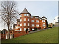
Osborne, Clive Crescent, Penarth
A side view of a modern apartment building named Osborne located at 7 Clive Crescent, about 50 metres west of the Bristol Channel shoreline.
Image: © Jaggery
Taken: 24 Nov 2010
0.03 miles
2
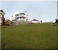
Narrow open space next to coastal slopes, Penarth
The view north along a 90 metres by 20 metres open space to the east of Clive Crescent (just beyond the lower left corner) and Penarth Head Lane (at the top left). Coastal slopes at Penarth Head begin just beyond the right edge of the view.
Image: © Jaggery
Taken: 24 Nov 2010
0.03 miles
3
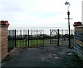
Gates at the far end of Penarth Head Lane, Penarth
The gates lead into an open space http://www.geograph.org.uk/photo/2173495 and a footpath down to Clive Crescent.
Image: © Jaggery
Taken: 24 Nov 2010
0.03 miles
4
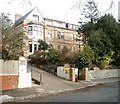
Cliffhaven, Penarth
Privately-owned retirement home for 19 residents, at 10 Clive Crescent.
Image: © Jaggery
Taken: 24 Nov 2010
0.05 miles
5
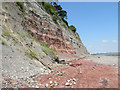
Scree at base of Penarth Cliffs
Although only a fairly gentle breeze was blowing, the cliffs made a constant rattling sound, and the stones the size of the smaller ones seen here were steadily streaming down them. Best not to stand too close!
Image: © Keith Edkins
Taken: 24 Jun 2009
0.06 miles
7
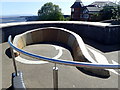
Viewpoint on Penarth Head Park
The viewpoint is made in the shape of the Coastal Path symbol
Image: © Eirian Evans
Taken: 4 May 2019
0.09 miles
8
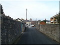
Penarth Head Lane, Penarth
Looking along Penarth Head Lane in the direction of Clive Place. The tower in the middle distance is part of St Augustine's Church. http://www.geograph.org.uk/photo/1952171
Image: © Jaggery
Taken: 24 Nov 2010
0.09 miles
9
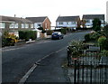
Penarth : SE end of Uppercliff Drive
Looking along Uppercliff Drive towards houses on Uppercliff Close.
Image: © Jaggery
Taken: 24 Nov 2010
0.09 miles
10
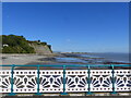
Cliff looking north from Penarth Pier
Image: © Ruth Sharville
Taken: 20 Sep 2021
0.10 miles