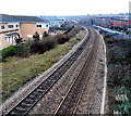
1
Civic Offices, Barry
The Vale of Glamorgan Council Civic Offices are in Holton Road, Barry.
This view is of the SE side, from the north side of Dock View Road.
Image: © Jaggery
Taken: 6 Jan 2013
0.01 miles
2
Council offices entrance road, Barry
From Dock View Road. A 5mph speed limit is in force behind the barrier.
Image: © Jaggery
Taken: 18 Aug 2016
0.03 miles
3
Three King vans in Dock View Road, Barry
Based in Cardiff and Bristol, R.G.D King Ltd provides structured cabling and associated services.
Image: © Jaggery
Taken: 18 Aug 2016
0.06 miles
4
Premier Blinds van in Dock View Road, Barry
Premier Blinds (Wales Ltd) is based in Heol Ty Gwyn Industrial Estate, Maesteg.
Image: © Jaggery
Taken: 18 Aug 2016
0.06 miles
5
Greenwood Street, Barry
Viewed from the Thompson Street end.
Image: © Jaggery
Taken: 17 Mar 2013
0.06 miles
6
Entrance to Broad Street Clinic, Barry
From Dock View Road into the Broad Street NHS (National Health Service) clinic site.
Image: © Jaggery
Taken: 18 Aug 2016
0.06 miles
7
Railway west from Thompson Street footbridge, Barry
Viewed from here. http://www.geograph.org.uk/photo/3319533 The next station ahead is Barry.
Waterfront Medical Centre http://www.geograph.org.uk/photo/3319544 is on the left.
Image: © Jaggery
Taken: 6 Jan 2013
0.06 miles
8
Sewage pumping station above Dock View Road, Barry
Welsh Water site.
Image: © Jaggery
Taken: 18 Aug 2016
0.07 miles
9
Newydd Housing Association office, Barry
Located at 121 Broad Street, next door to the Citizens Advice Bureau. http://www.geograph.org.uk/photo/3314219 Established in 1974, Newydd is a charitable housing association that offers affordable homes for rent or sale to people in Mid and South Wales.
Image: © Jaggery
Taken: 6 Jan 2013
0.07 miles
10
Barry Leisure Centre
Viewed from the north side of Dock View Road.
The leisure centre is located 100 metres east of the Civic Offices. http://www.geograph.org.uk/photo/3314262
Image: © Jaggery
Taken: 6 Jan 2013
0.08 miles


