1
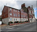
Dock View Road flats, Barry
Located between Kingsland Crescent and Station Street (ahead).
Image: © Jaggery
Taken: 26 Apr 2017
0.01 miles
2
Custom House, Barry, Dock View Rd frontage
Stone carving of the royal coat of arms above the bay window
Image: © John Lord
Taken: 4 Jun 2010
0.01 miles
3
Station Street side of the former Custom House, Barry
The former Custom House & Mercantile Marine Offices http://www.geograph.org.uk/photo/3359052 are now in use as flats.
Image: © Jaggery
Taken: 28 Feb 2013
0.01 miles
4
Ordnance Survey Cut Mark
This OS cut mark can be found on No41 Dock View Road, the Old Customs House. It marks a point 23.659m above mean sea level.
Image: © Adrian Dust
Taken: 3 Feb 2018
0.01 miles
5
Former Custom House & Mercantile Marine Offices, Barry
Now in use as flats, this substantial building occupies the corner of Station Street and Dock View Road. An inscription http://www.geograph.org.uk/photo/1897278 above the doorway records its former use. Built between 1901 and 1910, Grade II listed in 1990.
Image: © Jaggery
Taken: 28 Feb 2013
0.01 miles
6
Campbell Court, Barry
Campbell Court flats viewed across Dock View Road.
Image: © Jaggery
Taken: 26 Apr 2017
0.02 miles
7
An entrance path to Barry Docks railway station
Viewed across Dock View Road. The entrance is opposite Clemwood Stores http://www.geograph.org.uk/photo/3319610 and Kingsland Crescent.
Image: © Jaggery
Taken: 6 Jan 2013
0.03 miles
8
Ordnance Survey Cut Mark
This OS cut mark can be found on the west side of the subway next to the steps. It marks a point 11.7592m above mean sea level.
Image: © Adrian Dust
Taken: 3 Feb 2018
0.03 miles
9
Dipping Boneless Feast advert on a Dock View Road phonebox, Barry
The KFC advert is on a phonebox near the Station Street junction.
Image: © Jaggery
Taken: 26 Apr 2017
0.03 miles
10
KFC on a Dock View Road phonebox, Barry
KFC (Kentucky Fried Chicken) on this side, a more specific advert http://www.geograph.org.uk/photo/5368090 on the opposite side of the box.
Image: © Jaggery
Taken: 26 Apr 2017
0.03 miles


