1
Burlington Street, Barry
Looking towards Holton Road from the Dock View Road end of the street.
Image: © Jaggery
Taken: 16 Jun 2010
0.01 miles
2
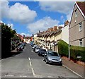
Up Coigne Terrace, Barry
Coigne Terrace ascends from Dock View Road towards Jewel Street.
Image: © Jaggery
Taken: 26 Apr 2017
0.04 miles
3
Row of houses, Dock View Road, Barry
Between Coigne Terrace and Morgan Street.
Image: © Jaggery
Taken: 26 Apr 2017
0.05 miles
4
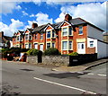
Row of houses, Dock View Road, Barry
Between Robert Street and Burlington Street.
Image: © Jaggery
Taken: 26 Apr 2017
0.05 miles
5
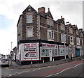
Mayflower Chinese takeaway, Barry
Viewed across Holton Road. Mayflower Chinese takeaway is at 40 Burlington Street, on the corner of Jewel Street.
Image: © Jaggery
Taken: 17 Mar 2013
0.05 miles
6
Bungalows, Holton Road, Barry
A block of bungalows with low-pitched roofs occupy a rectangle of land on the south side of Holton Road, between Robert Street and Wilfred Street.
Image: © Jaggery
Taken: 16 Jun 2010
0.06 miles
7
Sea Scouts premises, Barry
Premises of the 5th Barry (Holton Road Baptist) Sea Scouts, located on the corner of Holton Road and Everard Street. The building was originally a 'tin church' erected at Harbour Road for Bethel Baptists.
A prefabricated structure of wood and corrugated iron, it dates from 1893. When the congregation outgrew the building, it was taken down and re-erected here.
Image: © Jaggery
Taken: 16 Jun 2010
0.06 miles
8
Barry Tyre Centre, Barry
Located on the corner of Holton Road and Jewel Street.
A red arrow on a notice points left to the fitting bays in Jewel Street.
Image: © Jaggery
Taken: 17 Mar 2013
0.06 miles
9
Up Burlington Street, Barry
Burlington Street ascends from Dock View Road towards Holton Road.
Image: © Jaggery
Taken: 26 Apr 2017
0.06 miles
10
Burlington Street, Barry
Burlington Street descends away from Holton Road towards Dock View Road.
Image: © Jaggery
Taken: 17 Mar 2013
0.06 miles


