IMAGES TAKEN NEAR TO
St. Michaels Gardens, BARRY, CF62 9XP

Introduction

This page details the photographs taken nearby to St. Michaels Gardens, CF62 9XP by members of the Geograph project.

The Geograph project started in 2005 with the aim of publishing, organising and preserving representative images for every square kilometre of Great Britain, Ireland and the Isle of Man.

There are currently over 7.5m images from over14,400 individuals and you can help contribute to the project by visiting https://www.geograph.org.uk

Image Map


Images are licensed for reuse under creativecommons.org/licenses/by-sa/2.0
Notes
  • Clicking on the map will re-center to the selected point.
  • The higher the marker number, the further away the image location is from the centre of the postcode.

Image Listing (13 Images Found)

Images are licensed for reuse under creativecommons.org/licenses/by-sa/2.0
Image
Details
Distance
1
Children's Playground
Children's playground at Meggitt Road, Barry.
Image: © Alan Hughes Taken: 18 Nov 2016
0.10 miles
2
Takeaways etc., Winston Rd, Barry
Image: © John Lord Taken: 23 May 2010
0.11 miles
3
Barry Grid Substation
Secured entrance gates at Grid Substation on Port Road, Barry.
Image: © Alan Hughes Taken: 18 Nov 2016
0.14 miles
4
Barry : Port Road East A4050
Heading along Port Road East.
Image: © Lewis Clarke Taken: 23 Mar 2019
0.15 miles
5
Two semis and two detached houses, Winston Road, Barry
The houses are near the corner of Coleridge Crescent, ahead.
Image: © Jaggery Taken: 6 Jan 2013
0.16 miles
6
Tennyson Rd, Barry
In the distance, Steep Holm, in the Bristol Channel, can be seen mid-way between the two telegraph poles
Image: © John Lord Taken: 23 May 2010
0.20 miles
7
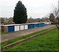
A row of 11 lockup garages, Merthyr Dyfan, Barry
Viewed from Winston Road. The garages can be reached by vehicle from either Coleridge Crescent or Whitewell Road.
Image: © Jaggery Taken: 6 Jan 2013
0.21 miles
8
Winston Road houses, Barry
The houses are in the Merthyr Dyfan area in the north of Barry.
Image: © Jaggery Taken: 6 Jan 2013
0.23 miles
9
Port Road East, Barry
Port Road East (the A4050) heads NE away from the Colcot area of Barry. The road ahead skirts the Merthyr Dyfan area of Barry.
Image: © Jaggery Taken: 6 Jan 2013
0.23 miles
10
Merthyr Dyfan Rd, Barry
Image: © John Lord Taken: 23 May 2010
0.23 miles