
IMAGES TAKEN NEAR TO
St. Pauls Avenue, BARRY, CF62 8HT
Introduction
This page details the photographs taken nearby to St. Pauls Avenue, CF62 8HT by members of the Geograph project.
The Geograph project started in 2005 with the aim of publishing, organising and preserving representative images for every square kilometre of Great Britain, Ireland and the Isle of Man.

There are currently over 7.5m images from over14,400 individuals and you can help contribute to the project by visiting https://www.geograph.org.uk
Image Map
Images are licensed for reuse under creativecommons.org/licenses/by-sa/2.0
Notes
- Clicking on the map will re-center to the selected point.
- The higher the marker number, the further away the image location is from the centre of the postcode.
Image Listing (155 Images Found)
Images are licensed for reuse under creativecommons.org/licenses/by-sa/2.0
Image
Details
Distance
1
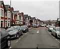
St Paul's Avenue west of Hilda Street, Barry
A view SW towards High Street.
Image: © Jaggery
Taken: 6 Jan 2013
0.01 miles
2
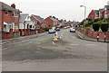
St Paul's Avenue, Barry
Viewed from the roundabout seen here. http://www.geograph.org.uk/photo/3296424
Image: © Jaggery
Taken: 6 Jan 2013
0.01 miles
3
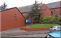
Entrance to the church of St Paul the Apostle, Barry
Viewed across St Paul's Road. Behind the church name board, steps lead up to the entrance doorway. The name shown on the board is
THE CHURCH IN WALES
THE PARISH OF MERTHYR DYFAN
ST PAUL THE APOSTLE.
Image: © Jaggery
Taken: 6 Jan 2013
0.02 miles
4
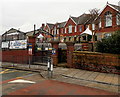
High Street Primary School, Barry
The confusinlgy-named High Street Primary School is located on the north side of St Paul's Avenue, about 100 metres east of the eastern end of High Street.
There is another primary school adjacent to this one, just out of shot on the left. It is Ysgol Sant Baruc, http://www.geograph.org.uk/photo/3300215 a Welsh medium school
Image: © Jaggery
Taken: 6 Jan 2013
0.04 miles
5
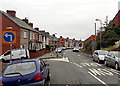
All traffic turn left here, St Paul's Avenue, Barry
A one-way system operates ahead, so all traffic heading SW along St Paul's Avenue
must turn left here into Hilda Street, which leads to Broad Street.
Image: © Jaggery
Taken: 6 Jan 2013
0.04 miles
6
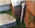
Ordnance Survey Cut Mark
This OS cut mark can be found on No78 Broad Street. It marks a point 25.024m above mean sea level.
Image: © Adrian Dust
Taken: 20 Sep 2021
0.05 miles
7
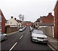
Hilda Street, Barry
Viewed from the Broad Street end looking towards St Paul's Avenue.
Image: © Jaggery
Taken: 6 Jan 2013
0.06 miles
8
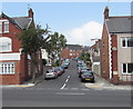
Hilda Street, Barry
Ascending from the A4055 Broad Street towards St Paul's Avenue.
Image: © Jaggery
Taken: 18 Aug 2016
0.06 miles
9
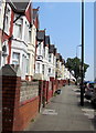
Pavement and long row of houses, Broad Street, Barry
On the north side of the A4055 Broad Street.
Image: © Jaggery
Taken: 18 Aug 2016
0.06 miles
10
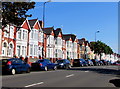
On-street parking, Broad Street, Barry
There are no double yellow lines on this part of the A4055 Broad Street in September 2019.
Image: © Jaggery
Taken: 8 Sep 2019
0.06 miles