1
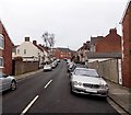
Montgomery Road, Barry
Montgomery Road climbs away from the roundabout seen here. http://www.geograph.org.uk/photo/3296424
Image: © Jaggery
Taken: 6 Jan 2013
0.02 miles
2
Entrance to the church of St Paul the Apostle, Barry
Viewed across St Paul's Road. Behind the church name board, steps lead up to the entrance doorway. The name shown on the board is
THE CHURCH IN WALES
THE PARISH OF MERTHYR DYFAN
ST PAUL THE APOSTLE.
Image: © Jaggery
Taken: 6 Jan 2013
0.05 miles
3
College Place, Barry
Viewed from the grass triangle at the junction of College Road
and College Place, looking along College Place towards Montgomery Road.
Image: © Jaggery
Taken: 6 Jan 2013
0.05 miles
4
All traffic turn left here, St Paul's Avenue, Barry
A one-way system operates ahead, so all traffic heading SW along St Paul's Avenue
must turn left here into Hilda Street, which leads to Broad Street.
Image: © Jaggery
Taken: 6 Jan 2013
0.05 miles
5
Hilda Street, Barry
Viewed from the Broad Street end looking towards St Paul's Avenue.
Image: © Jaggery
Taken: 6 Jan 2013
0.06 miles
6
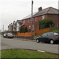
St Paul's Avenue houses at a roundabout, Barry
Viewed from College Road.
Image: © Jaggery
Taken: 6 Jan 2013
0.07 miles
7
College Place houses, Barry
Viewed from the grass triangle at the junction of College Road and College Place.
Image: © Jaggery
Taken: 6 Jan 2013
0.07 miles
8
High Street Primary School, Barry
The confusinlgy-named High Street Primary School is located on the north side of St Paul's Avenue, about 100 metres east of the eastern end of High Street.
There is another primary school adjacent to this one, just out of shot on the left. It is Ysgol Sant Baruc, http://www.geograph.org.uk/photo/3300215 a Welsh medium school
Image: © Jaggery
Taken: 6 Jan 2013
0.07 miles
9
St Paul's Avenue, Barry
Viewed from the roundabout seen here. http://www.geograph.org.uk/photo/3296424
Image: © Jaggery
Taken: 6 Jan 2013
0.07 miles
10
St Paul's Avenue west of Hilda Street, Barry
A view SW towards High Street.
Image: © Jaggery
Taken: 6 Jan 2013
0.07 miles


