
IMAGES TAKEN NEAR TO
Heol-y-Bryn, BARRY, CF62 6SY
Introduction
This page details the photographs taken nearby to Heol-y-Bryn, CF62 6SY by members of the Geograph project.
The Geograph project started in 2005 with the aim of publishing, organising and preserving representative images for every square kilometre of Great Britain, Ireland and the Isle of Man.

There are currently over 7.5m images from over14,400 individuals and you can help contribute to the project by visiting https://www.geograph.org.uk
Image Map
Images are licensed for reuse under creativecommons.org/licenses/by-sa/2.0
Notes
- Clicking on the map will re-center to the selected point.
- The higher the marker number, the further away the image location is from the centre of the postcode.
Image Listing (90 Images Found)
Images are licensed for reuse under creativecommons.org/licenses/by-sa/2.0
Image
Details
Distance
1
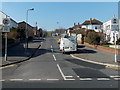
Heol y Bryn, The Knap, Barry
Viewed from Bron y Mor looking towards Maes y Coed.
Image: © Jaggery
Taken: 5 Mar 2013
0.02 miles
2
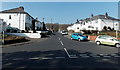
Birch Grove, The Knap, Barry
Birch Grove is a 120 metre long cul-de-sac, viewed across Bron y Mor.
Image: © Jaggery
Taken: 5 Mar 2013
0.05 miles
3
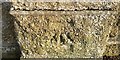
Ordnance Survey Cut Mark
This OS cut mark can be found on the wall of Cold Knap Gardens. It marks a point 10.220m above mean sea level.
Image: © Adrian Dust
Taken: 28 Feb 2018
0.05 miles
4
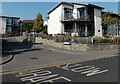
Y Cerigos, The Knap, Barry
Y Cerigos is a residential cul-de-sac, viewed from Bron-y-Mor.
Image: © Jaggery
Taken: 5 Mar 2013
0.06 miles
5
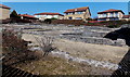
Roman ruins in Cold Knap, Barry
The following text is based on information on the Vale of Glamorgan Council website.
These are the footings of a substantial Roman building constructed of local limestone and originally roofed with ceramic tiles, on a point overlooking the Bristol Channel, now incongruously set among modern seaside development. Up to 19 rooms surrounded a central courtyard. It is unknown whether the building was of more than one storey. An external veranda ran the length of the SW side.
Construction began towards the end of the third century (AD) but seems not to have been completed. This and other evidence for Roman activity suggests that the building may have been intended as a storehouse or an official guesthouse, as part of maritime links between what are now South Wales and South West England. It is thought that the building, if it was ever completed, was in use only for a short time before being stripped and demolished.
Image: © Jaggery
Taken: 5 Mar 2013
0.09 miles
6
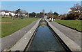
Feeder channel, Marine Lake, Barry
Viewed from the northern edge of the lake in the Knap Gardens.
Image: © Jaggery
Taken: 5 Mar 2013
0.09 miles
7
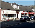
The Lake Shop, Barry
The Lake Shop on the left is at 6 Bron y Mor. Picnics takeaway is next door.
Image: © Jaggery
Taken: 5 Mar 2013
0.09 miles
8
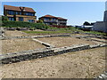
Roman remains, the Knap
On the bank near the Knap car park are the remains of a large Roman building, believed to have been constructed c 290 A.D. Limestone and brick was taken from the site in the Middle Ages and used to build Barry Castle.
Image: © Eirian Evans
Taken: 23 Jun 2021
0.09 miles
9
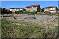
Remains of Roman building, The Knapp
Bases of the limestone walls of a late Roman building around a central courtyard; of uncertain function. Situated next to the Wales Coast Path amongst modern dwellings. For a better view of the far end of the site - Image
Image: © M J Roscoe
Taken: 6 Sep 2021
0.09 miles
10
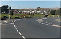
Junction of The Parade and Lakeside, Barry
Vehicles joining Lakeside from The Parade (at lower right) have priority over vehicles on Lakeside on the left.
Image: © Jaggery
Taken: 5 Mar 2013
0.10 miles