IMAGES TAKEN NEAR TO
The Parade, BARRY, CF62 6SE

Introduction

This page details the photographs taken nearby to The Parade, CF62 6SE by members of the Geograph project.

The Geograph project started in 2005 with the aim of publishing, organising and preserving representative images for every square kilometre of Great Britain, Ireland and the Isle of Man.

There are currently over 7.5m images from over14,400 individuals and you can help contribute to the project by visiting https://www.geograph.org.uk

Image Map


Images are licensed for reuse under creativecommons.org/licenses/by-sa/2.0
Notes
  • Clicking on the map will re-center to the selected point.
  • The higher the marker number, the further away the image location is from the centre of the postcode.

Image Listing (143 Images Found)

Images are licensed for reuse under creativecommons.org/licenses/by-sa/2.0
  • ...
Image
Details
Distance
1
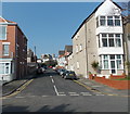
The Parade SW of Charles Place, Barry
The turning for Charles Place http://www.geograph.org.uk/photo/3494714 is on the right.
Image: © Jaggery Taken: 5 Mar 2013
0.01 miles
2
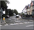
Gaspard Place, Barry
Viewed from The Parade. The street is named after members of the Romilly family (of French Huguenot descent) who were formerly major landowners in the area. The 3rd Baron Romilly (1866–1905) was John Gaspard le Marchant Romilly. The 4th Baron Romilly (1899–1983) was William Gaspard Guy Romilly.
Image: © Jaggery Taken: 5 Mar 2013
0.04 miles
3
Ordnance Survey Cut Mark
This OS cut mark can be found on No35 The Parade. It marks a point 15.298m above mean sea level.
Image: © Adrian Dust Taken: 28 Feb 2018
0.05 miles
4
The Parade SW of Gaspard Place, Barry
The turning for Gaspard Place http://www.geograph.org.uk/photo/3494735 is on the right.
Image: © Jaggery Taken: 5 Mar 2013
0.05 miles
5
Charles Place, Barry
Viewed from The Parade.
Image: © Jaggery Taken: 5 Mar 2013
0.05 miles
6
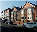
The Parade, Barry
The Parade leads to Marine Lake and The Knap.
Image: © Jaggery Taken: 11 Sep 2019
0.06 miles
7
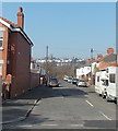
NE end of The Parade, Barry
Viewed from opposite Giuliano's Italian Restaurant. http://www.geograph.org.uk/photo/3494686
Image: © Jaggery Taken: 5 Mar 2013
0.07 miles
8
Waste ground between Romilly Park Road and railway lines, Barry
Viewed in early March 2013. A nearby Priory Estates notice states that this is a prime location plot with full planning permission for an "executive home ● 5 bedrooms● detached● off-road parking● luxury build. Price on application."
Image: © Jaggery Taken: 5 Mar 2013
0.07 miles
9
Southesk Place, Barry
Viewed from The Parade.
Image: © Jaggery Taken: 5 Mar 2013
0.07 miles
10
A diesel multiple unit heads for Barry
Class 150/2 DMU number 150 254 passes a looped charter train, with houses on Romily Park Road on the left.
Image: © Roger Templeman Taken: 14 Jan 2012
0.08 miles
  • ...