1
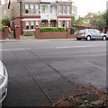
Junction of Romilly Avenue and Romilly Park Road, Barry
Viewed from the southern end of Romilly Avenue.
Image: © Jaggery
Taken: 11 Sep 2019
0.01 miles
2
Ordnance Survey Cut Mark
This OS cut mark can be found on No12 Romilly Park Road. It marks a point 21.909m above mean sea level.
Image: © Adrian Dust
Taken: 28 Feb 2018
0.02 miles
3
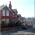
Romilly Avenue houses, Barry
On the approach to the Romilly Park Road junction.
Image: © Jaggery
Taken: 11 Sep 2019
0.02 miles
4
King George V pillarbox, Romilly Park Road, Barry
Located near the corner of Romilly Avenue. The GR on the box is short for Georgius Rex,
Latin for King George, in this case King George V who reigned from May 1910-January 1936.
Image: © Jaggery
Taken: 11 Sep 2019
0.02 miles
5
Two strips across Romilly Park Road, Barry
The strips detect the passage of vehicles. The information is
recorded by a Tracsis Traffic Data Ltd meter https://www.geograph.org.uk/photo/6264140 near the camera.
Image: © Jaggery
Taken: 11 Sep 2019
0.03 miles
6
Tracsis meter at the edge of a tree, Romilly Park Road, Barry
In September 2019, text on the small Tracsis Traffic Data Ltd meter shows Survey in Progress.
Two strips https://www.geograph.org.uk/photo/6264144 across the road detect the passage of vehicles.
Image: © Jaggery
Taken: 11 Sep 2019
0.03 miles
7
Houses on the north side of The Grove, Barry
The Grove descends from St Nicholas Road towards Romilly Park Road.
Image: © Jaggery
Taken: 5 Mar 2013
0.04 miles
8
Vehicle-lined road in suburban Barry
The Grove ascends from Romilly Park Road towards St Nicholas Road.
Image: © Jaggery
Taken: 11 Sep 2019
0.04 miles
9
Car-lined Romilly Avenue, Barry
Romilly Avenue descends from Old Village Road.
Image: © Jaggery
Taken: 11 Sep 2019
0.04 miles
10
Houses on the south side of The Grove, Barry
The Grove descends from St Nicholas Road towards Romilly Park Road.
Image: © Jaggery
Taken: 5 Mar 2013
0.05 miles


