
IMAGES TAKEN NEAR TO
Dunraven Street, BARRY, CF62 6PF
Introduction
This page details the photographs taken nearby to Dunraven Street, CF62 6PF by members of the Geograph project.
The Geograph project started in 2005 with the aim of publishing, organising and preserving representative images for every square kilometre of Great Britain, Ireland and the Isle of Man.

There are currently over 7.5m images from over14,400 individuals and you can help contribute to the project by visiting https://www.geograph.org.uk
Image Map
Images are licensed for reuse under creativecommons.org/licenses/by-sa/2.0
Notes
- Clicking on the map will re-center to the selected point.
- The higher the marker number, the further away the image location is from the centre of the postcode.
Image Listing (119 Images Found)
Images are licensed for reuse under creativecommons.org/licenses/by-sa/2.0
Image
Details
Distance
1
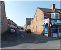
Glamorgan Street, Barry
Glamorgan Street climbs away from Park Crescent. Selleys Newsagents http://www.geograph.org.uk/photo/3361958 is on the right.
Image: © Jaggery
Taken: 5 Mar 2013
0.07 miles
2
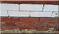
Ordnance Survey Cut Mark
This OS cut mark can be found on No60 Salisbury Road. It marks a point 61.091m above mean sea level.
Image: © Adrian Dust
Taken: 28 Feb 2018
0.07 miles
3
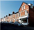
North side of Vale Street, Barry
Viewed from the Park Crescent end looking past Harvey's Fish 'n' Chips shop.
Image: © Jaggery
Taken: 5 Mar 2013
0.07 miles
4
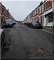
Vale Street, Barry
From the west side of the A4050 Park Crescent, Vale Street ascends towards Salisbury Road.
Harvey's Fish 'n' Chips shop https://www.geograph.org.uk/photo/6263525 is on the right.
Image: © Jaggery
Taken: 11 Sep 2019
0.08 miles
5
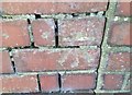
Ordnance Survey Cut Mark
This OS cut mark can be found on No6 Salisbury Road. It marks a point 59.104m above mean sea level.
Image: © Adrian Dust
Taken: 28 Feb 2018
0.09 miles
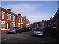
7
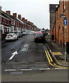
One-way Glamorgan Street, Barry
From the A4050 Park Crescent, Glamorgan Street ascends towards Salisbury Road.
A one-way sign is on the right.
Image: © Jaggery
Taken: 11 Sep 2019
0.10 miles
8
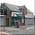
Vale Street Post Office, Barry
At 113 Park Crescent, opposite Vale Street, one of seven parallel streets connecting Park Crescent and Salisbury Road.
Image: © Jaggery
Taken: 6 Jun 2010
0.10 miles
9
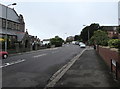
West along Park Road, Barry
All Saints' Church https://www.geograph.org.uk/photo/6264469 is on the left.
Image: © Jaggery
Taken: 11 Sep 2019
0.10 miles
10
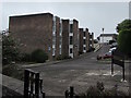
Courtlands, Park Road, Barry
Flats set back from the south side of Park Road near All Saints' Church.
Image: © Jaggery
Taken: 11 Sep 2019
0.11 miles