1
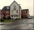
Modern housing in Barry Island
The street on the left is named Gwennol y Craig. Clos yr Wylan is on the right.
Image: © Jaggery
Taken: 30 Dec 2012
0.02 miles
2
Path above Jackson's Bay, Barry
Jackson's Bay is below the fence on the left.
Image: © Jaggery
Taken: 30 Dec 2012
0.03 miles
3
Boulders, sand, sea and houses, Jackson's Bay, Barry
Image: © Jaggery
Taken: 30 Dec 2012
0.03 miles
4
Path on clifftop above Jackson's Bay
The Wales Coast Path follows the path; on the left it goes on the path behind the litter bin.
Image: © M J Roscoe
Taken: 6 Sep 2021
0.04 miles
5
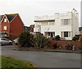
Distinctive white house in Barry Island
Located at the southern end of Friars Road, this house is distinctly unlike neighbouring houses.
Image: © Jaggery
Taken: 30 Dec 2012
0.05 miles
6
Detail of cliff face
Close up of cliff face at Jackson’s Bay.
Image: © Alan Hughes
Taken: 22 Oct 2019
0.06 miles
7
Path onto Jacksons Beach
The path is Clements Colley Walk which runs around Nell's Point on Barry Island.
Image: © DS Pugh
Taken: 24 Jun 2024
0.07 miles
8
Heol Eryr M?r, Barry Island
Modern housing beyond the southern end of Friars Road.
Image: © Jaggery
Taken: 30 Dec 2012
0.07 miles
9
Remains of St Baruch's chapel, Barry Island
Located in a fenced compound on the east side of Friars Road, these are the ruins of a small pilgrimage chapel of medieval (c12th-14th century) origin. Said to be the site of the grave of a Celtic saint, perhaps an itinerant Irishman, Barruc alias Finbar, the patron saint of Cork. Excavations have shown that there was an older burial ground on this site. The chapel was abandoned in the early 16th century and the ruins were gradually engulfed by sand dunes.
Image: © Jaggery
Taken: 30 Dec 2012
0.07 miles
10
Barry Island and Nell's Point
Looking across the harbour to the Council Offices on the centre.
Image: © M J Richardson
Taken: 4 Oct 2010
0.07 miles


