1
Former dockside railway, Barry
Image: © Gareth James
Taken: 6 Sep 2009
0.01 miles
2
Ordnance Survey Rivet
This OS rivet can be found at the base of a bollard SE side of Dock No1. It marks a point 7.870m above mean sea level.
Image: © Adrian Dust
Taken: 20 Sep 2021
0.04 miles
3
Steps down from Clive Road, Barry
Image: © Gareth James
Taken: 6 Sep 2009
0.06 miles
4
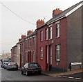
Clive Road houses east of Bromfield Road, Barry Island
Clive Road houses are all on one side of the street. On the opposite side
is a boundary fence at the edge of Barry docks.
Image: © Jaggery
Taken: 30 Dec 2012
0.07 miles
5
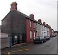
Clive Road houses west of the primary school, Barry Island
The black gates are at an entrance to Barry Island Primary School and Nursery. http://www.geograph.org.uk/photo/3276615
Clive Road houses are all on one side of the street. On the opposite side
is a boundary fence at the edge of Barry docks.
Image: © Jaggery
Taken: 30 Dec 2012
0.07 miles
6
Path from Clive Road to the waterfront, Barry Island
Viewed through a pair of old metal posts, probably late Victorian.
The notice on the right states that this access to the waterfront is suitable for pedestrians only. A glance along the route confirms this statement. There are steps, and a metal barrier across part of the route ahead.
Image: © Jaggery
Taken: 30 Dec 2012
0.07 miles
7
West side of Barry Island Primary School and Nursery
This is the Clive Road side of the school which occupies a site on the corner of Archer Road.
Image: © Jaggery
Taken: 30 Dec 2012
0.08 miles
8
Ordnance Survey Cut Mark
This OS cut mark can be found on the north face of the school, Clive Road. It marks a point 17.550m above mean sea level.
Image: © Adrian Dust
Taken: 11 Mar 2018
0.08 miles
9
Foundations of former oil storage tanks, Barry
Image: © Gareth James
Taken: 6 Sep 2009
0.09 miles
10
Phyllis Street west of Archer Road, Barry Island
Viewed across Archer Road from near St Baruc's Church (on the left). http://www.geograph.org.uk/photo/3277405
This view along Phyllis Street is looking in the direction of Bromfield Road.
Image: © Jaggery
Taken: 30 Dec 2012
0.10 miles


