1
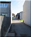
Shackleton Close, St Athan
Another of the housing estates built for personnel serving at RAF St Athan that has been transferred to private hands. The uniformity demanded of service resident has now disappeared as homes have acquired conservatories, double glazing and even mock Tudor styling.
The houses on this estate were named after explorers of note.
Image: © Mick Lobb
Taken: 3 May 2009
0.02 miles
2
Clive Road, St Athan
From the east side of Cowbridge Road, Clive Road leads to Shackleton Close and Drake Close.
Image: © Jaggery
Taken: 13 Sep 2019
0.02 miles
3
Basket or Netball court, St Athan
Probably once used by military personnel based or training on the camp.
Image: © Mick Lobb
Taken: 3 May 2009
0.03 miles
4
The Royal Air Force Falcons Display Team - St Athan
Exiting their aircraft at 12,000 ft the team free fall to 4,000 ft having reached a speed of some 120 mph. At this point their canopies have been released and they form up for a variety of turns and spirals. The canopies used are steerable so at the appropriate time they steer to approach the DZ (Drop Zone) into wind to land.
Image: © Mick Lobb
Taken: 9 Jul 2013
0.05 miles
5
Housing near Flemingston
Image: © John Lord
Taken: 7 Feb 2014
0.06 miles
6
Housing near Flemingston
Former military housing?
Image: © John Lord
Taken: 7 Feb 2014
0.07 miles
7
St.Athan Golf Club
First tee at St.Athan Golf Club.
Image: © Alan Hughes
Taken: 31 Oct 2016
0.07 miles
8
Airfield entrance - St Athan
During its lifetime as an RAF unit the airfield was pretty much divided into two halves with separate functions of maintenance and of training. This is one side of the entrance gate on East Camp that held the training facility and some elements of maintenance.
The site is now in the hands of the Welsh Assembly Government (WAG) hence its apparent crisis of identity. This photograph shows it to be the home of Forward Support (Fixed Wing) a maintenance function, and of No 4 School of Technical Training.
One of two adjacent imposing gates that lead to confusion among visitors.
Image: © Mick Lobb
Taken: 7 Aug 2009
0.08 miles
9
Livingstone Way, St Athan
From the east side of Cowbridge Road.
Image: © Jaggery
Taken: 13 Sep 2019
0.08 miles
10
Airfield entrance - St Athan
During its life as an RAF unit the airfield was pretty much divided into two halves with separate functions of maintenance and of training. This is one side of the entrance gate on East Camp that held the training facility and some elements of maintenance.
The site is now in the hands of the Welsh Assembly Government (WAG) hence its apparent crisis of identity. This photograph shows it to be the home of the Defence College of Electro-Mechanical Engineering, No 4 School of Technical Training.
One of two adjacent imposing gates that lead to confusion among visitors.
Image: © Mick Lobb
Taken: 7 Aug 2009
0.08 miles


