
IMAGES TAKEN NEAR TO
Murlande Way, BARRY, CF62 3HN
Introduction
This page details the photographs taken nearby to Murlande Way, CF62 3HN by members of the Geograph project.
The Geograph project started in 2005 with the aim of publishing, organising and preserving representative images for every square kilometre of Great Britain, Ireland and the Isle of Man.

There are currently over 7.5m images from over14,400 individuals and you can help contribute to the project by visiting https://www.geograph.org.uk
Image Map
Images are licensed for reuse under creativecommons.org/licenses/by-sa/2.0
Notes
- Clicking on the map will re-center to the selected point.
- The higher the marker number, the further away the image location is from the centre of the postcode.
Image Listing (14 Images Found)
Images are licensed for reuse under creativecommons.org/licenses/by-sa/2.0
Image
Details
Distance
1
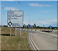
Porthkerry Road, Rhoose
Looking towards the roundabout at the Pentir y De junction.
Image: © Jaggery
Taken: 11 Jun 2011
0.13 miles
2
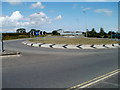
Porthkerry Road roundabout, Rhoose
The roundabout is at the junction of Porthkerry Road and Pentir y De. Distances in miles shown on the sign at the far end of the roundabout are Porthkerry ½, Cardiff Airport 1½, Barry 4.
Image: © Jaggery
Taken: 11 Jun 2011
0.14 miles
3
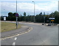
Road from Rhoose to Rhoose Point
The road named Pentir y De heads away from Porthkerry Road
at the eastern edge of Rhoose, towards Rhoose Point on the coast.
Image: © Jaggery
Taken: 11 Jun 2011
0.15 miles
4
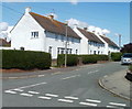
Ceri Avenue, Rhoose
Houses on the north side of Ceri Avenue viewed from Ceri Road.
Image: © Jaggery
Taken: 11 Jun 2011
0.15 miles
5
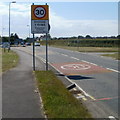
Eastern boundary of Rhoose
Porthkerry Road reaches Rhoose, a coastal village in the Vale of Glamorgan.
There are two different types of boundary sign here. The larger one emphasises the 30mph speed limit ahead. The smaller one near the left edge of the view shows Welcome to Rhoose and its Welsh language equivalent.
Image: © Jaggery
Taken: 11 Jun 2011
0.15 miles
6
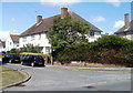
Southern end of Ceri Road, Rhoose
Viewed across Porthkerry Road.
Image: © Jaggery
Taken: 11 Jun 2011
0.16 miles
7
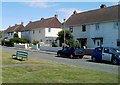
Ceri Road houses and a bench, Rhoose
The houses face the southern edge of a recreation ground.
Image: © Jaggery
Taken: 11 Jun 2011
0.18 miles
8
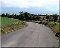
A glimpse of the sea from Pentir y De near Rhoose
A view south along a farm road towards the Bristol Channel coast.
Image: © Jaggery
Taken: 11 Jun 2011
0.18 miles
9
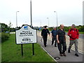
Gadael Rhws / Leaving Rhoose
Cerddwyr yn gadael pentre Y Rhws (< Y Rhos).
Walkers leaving the village of Rhoose < Rhos (trans. the moorland).
Image: © Alan Richards
Taken: 3 Jun 2007
0.19 miles
10
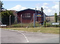
Army Cadet Force hall, Rhoose
Located on the corner of Ceri Road and Meadowcroft, the hall is used by
the Army Cadet Force (3rd Cadet Battalion, The Royal Welsh) Rhoose Detachment.
Image: © Jaggery
Taken: 11 Jun 2011
0.21 miles