IMAGES TAKEN NEAR TO
Wharton Close, BARRY, CF62 3EG

Introduction

This page details the photographs taken nearby to Wharton Close, CF62 3EG by members of the Geograph project.

The Geograph project started in 2005 with the aim of publishing, organising and preserving representative images for every square kilometre of Great Britain, Ireland and the Isle of Man.

There are currently over 7.5m images from over14,400 individuals and you can help contribute to the project by visiting https://www.geograph.org.uk

Image Map


Images are licensed for reuse under creativecommons.org/licenses/by-sa/2.0
Notes
  • Clicking on the map will re-center to the selected point.
  • The higher the marker number, the further away the image location is from the centre of the postcode.

Image Listing (9 Images Found)

Images are licensed for reuse under creativecommons.org/licenses/by-sa/2.0
Image
Details
Distance
1
Water lily
Image: © Alan Hughes Taken: 6 Jun 2024
0.11 miles
2
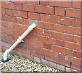
Ordnance Survey Cut Mark
This OS cut mark can be found on the wall of No124 Font-y-gary Road. It marks a point 36.502m above mean sea level.
Image: © Adrian Dust Taken: 28 Sep 2022
0.11 miles
3
Pond life
A water snail.
Image: © Alan Hughes Taken: 6 Jun 2024
0.11 miles
4
Railway Bridge at Font-y-Gary, Rhoose, Vale of Glamorgan.
Passenger rail services have recently returned to the Vale railway line which crosses this bridge. It is now possible to catch the train to Cardiff Airport (Bus connection from Rhoose station) and Llantwit Major from Cardiff.
Image: © Peter Wasp Taken: 21 Mar 2007
0.21 miles
5
Railway bridge at Font-y-Gary Park
Image: © Gareth James Taken: 11 Aug 2010
0.22 miles
6
Ordnance Survey Cut Mark
This OS cut mark can be found on No73 Font-Y-Gary Road. It marks a point 43.137m above mean sea level.
Image: © Adrian Dust Taken: 11 Mar 2018
0.22 miles
7
The Fontygary Inn, Rhoose
Image: © Mick Lobb Taken: 25 Nov 2008
0.22 miles
8
Ffontygary Inn by Night
Image: © Guy Butler-Madden Taken: 22 Aug 2015
0.23 miles
9
Ordnance Survey Cut Mark
This OS cut mark can be found on the barn north side of the road. It marks a point 33.844m above mean sea level.
Image: © Adrian Dust Taken: 28 Sep 2022
0.24 miles