1
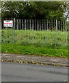
De Clare Court houses and trees, Llantwit Major
Set back from the west side of Eagleswell Road.
Image: © Jaggery
Taken: 25 Sep 2019
0.07 miles
2
Refuse awaiting collection in Llantwit Major
The common sight of rubbish bags left for collection on our streets as we struggle to cope with our waste materials.
Image: © Mick Lobb
Taken: 5 Jan 2009
0.08 miles
3
Unnamed side road in suburban Llantwit Major
On the west side of Eagleswell Road near De Clare Court. https://www.geograph.org.uk/photo/6278452
Image: © Jaggery
Taken: 25 Sep 2019
0.08 miles
4
Windsor Close, Llantwit Major
Image: © Mick Lobb
Taken: 5 Jan 2009
0.09 miles
5
Zigzag yellow markings on Eagleswell Road, Llantwit Major
Marking a School Keep Clear Zone, the yellow markings remain in September 2019, several years after Eagleswell Primary & Nursery School closed down. Satellite views show that the school buildings have been demolished.
Image: © Jaggery
Taken: 25 Sep 2019
0.09 miles
6
Row of houses on the west side of Eagleswell Road, Llantwit Major
Viewed from Bedford Rise.
Image: © Jaggery
Taken: 25 Sep 2019
0.10 miles
7
Vachell Court, Llantwit Major
One of several 'Courts' comprising this council estate.
Image: © Mick Lobb
Taken: 5 Jan 2009
0.10 miles
8
KEEP OUT notice on railings, Eagleswell Road, Llantwit Major
Viewed in September 2019. The Cuddy Group notice is on perimeter railings at the southwest edge of the site formerly occupied by Eagleswell Primary & Nursery School. Satellite views show that the school buildings have been demolished.
Image: © Jaggery
Taken: 25 Sep 2019
0.10 miles
9
Eagleswell Road bus stop and shelter, Llantwit Major
In September 2019 this is a stop on two bus routes - route 303 to Barry and route 321 to Talbot Green via Cowbridge. The railings are at the edge of a derelict site formerly occupied by a school.
Image: © Jaggery
Taken: 25 Sep 2019
0.11 miles
10
Bedford Road houses, Llantwit Major
Houses on the south side of Bedford Rise west of the Grey's Drive junction.
Image: © Jaggery
Taken: 25 Sep 2019
0.12 miles


