1
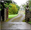
Entrance gate and lodge - St Donat's Castle and College
Image: © Mick Lobb
Taken: 21 Jun 2010
0.04 miles
2
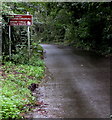
End of the 30 zone, Dimlands Road, St Donats
At the southeast edge of St Donats, the 30mph speed limit increases
to the National Speed Limit. Llantwit Major is about 3km ahead.
Image: © Jaggery
Taken: 11 Sep 2019
0.05 miles
3
Dimlands Road, St Donats
This is a view toward Llantwit Major from near the gate of the United World College of the Atlantic. This is an international, sixth form college.
Image: © Mick Lobb
Taken: 11 Feb 2009
0.05 miles
4
Stone lions at the entrance to The Old Vicarage, St Donats
On the north side of Dimlands Road. The stone lion on the left is partly hidden by vegetation.
Image: © Jaggery
Taken: 11 Sep 2019
0.06 miles
5
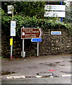
Bus stop and direction signs, Dimlands Road, St Donats
This is a stop on bus route 303 from Barry to Bridgend.
In September 2019 route 303 is operated by NAT Group.
Signs show right for St Donats Church, Arts Centre and Atlantic College.
Left along Dimlands Road for Llantwit Major.
Image: © Jaggery
Taken: 11 Sep 2019
0.06 miles
6
Ordnance Survey Cut Mark
This OS cut mark can be found on the East Lodge. It marks a point 53.078m above mean sea level.
Image: © Adrian Dust
Taken: 31 Dec 2021
0.07 miles
7
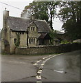
Grade II Listed lodge at the entrance to St Donats Castle and College, Vale of Glamorgan
Cadw records that the lodge dated 1905 was built for Morgan Stuart Williams of St Donats Castle and Aberpergwm. It was designed in a Cotswold style, possibly by Bodley and Garner who were working on the castle at that time.
Image: © Jaggery
Taken: 11 Sep 2019
0.07 miles
8
Bilingual brown sign alongside Dimlands Road, St Donats
The sign shows Arts Centre and Atlantic College and their Welsh equivalents.
Image: © Jaggery
Taken: 11 Sep 2019
0.10 miles
9
Cloudscape at sunset
Evening Cloudscape at St.Donats, Llantwit Major.
Image: © Alan Hughes
Taken: 6 Jul 2014
0.10 miles
10
Partly overgrown bench alongside Dimfields Road, St Donats
Weeds are encroaching in September 2019.
Image: © Jaggery
Taken: 11 Sep 2019
0.11 miles


