IMAGES TAKEN NEAR TO
Boverton Park Drive, LLANTWIT MAJOR, CF61 1YN
Introduction
This page details the photographs taken nearby to Boverton Park Drive, CF61 1YN by members of the Geograph project.
The Geograph project started in 2005 with the aim of publishing, organising and preserving representative images for every square kilometre of Great Britain, Ireland and the Isle of Man.

There are currently over 7.5m images from over14,400 individuals and you can help contribute to the project by visiting https://www.geograph.org.uk
Image Map
Images are licensed for reuse under creativecommons.org/licenses/by-sa/2.0
Notes
- Clicking on the map will re-center to the selected point.
- The higher the marker number, the further away the image location is from the centre of the postcode.
Image Listing (89 Images Found)
Images are licensed for reuse under creativecommons.org/licenses/by-sa/2.0
Image
Details
Distance
1

Cherry Tree Cottage, Boverton
Set back from the corner of Boverton Road and Boverton Park Drive.
Image: © Jaggery
Taken: 25 Sep 2019
0.00 miles
2

Boverton Park Drive, Boverton
Cul-de-sac on the south side of Boverton Road.
A notice near the camera shows PRIVATE DRIVE - NO PUBLIC ACCESS.
Image: © Jaggery
Taken: 25 Sep 2019
0.02 miles
5
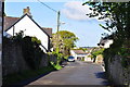
The old Boverton Road - Boverton
This was the old road into Boverton and Llantwit Major before the town by-pass was built in the 1960's.
Image: © Mick Lobb
Taken: 3 May 2009
0.04 miles
6
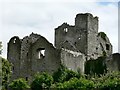
The Tower, Boverton Manor House, Boverton.
Image: © Mick Lobb
Taken: 8 Jul 2008
0.04 miles
7
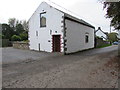
Threshing Barn, Boverton Road, Boverton
Former agricultural building converted to residential use.
Image: © Jaggery
Taken: 25 Sep 2019
0.04 miles
8

Boverton Park, Boverton
Cul-de-sac on the north side of Boverton Road.
Image: © Jaggery
Taken: 25 Sep 2019
0.04 miles
9
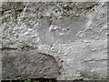
Ordnance Survey Cut Mark
This damaged OS cut mark can be found on the barn south side of the road. It marks a point 40.955m above mean sea level.
Image: © Adrian Dust
Taken: 6 Sep 2022
0.04 miles